Paralía Vérgas geodata
Paralía Vérgas (Peloponnese) is a populated place; located in Greece in Europe/Athens (GMT+3) time zone. With population of 1,966 people, there are 527 cities with bigger population in this country. Compared to other cities in Greece, 90% of cities are located further ↑North; 68.5% of cities are located further →East and 73% of cities have higher elevation than Paralía Vérgas. Note1


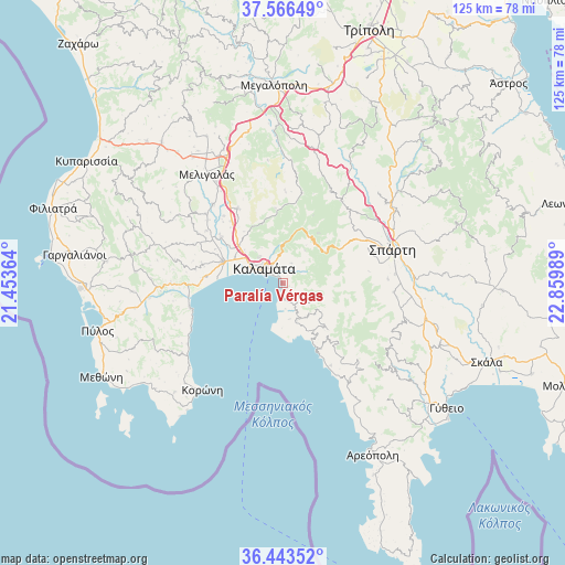
Paralía Vérgas GPS coordinates[2]
37° 0' 25.488" North, 22° 9' 24.336" East
| Map corner | latitude | longitude |
|---|---|---|
| Upper-left | 37.56649°, | 21.45364° |
| Center: | 37.00708°, | 22.15676° |
| Lower-right: | 36.44352°, | 22.85989° |
| Map W x H: | 124.9×124.9 km | = 77.6×77.6mi |
| max Lat: | 41.72048° ⇑90% North |
| Paralía Vérgas: | 37.00708° |
| min Lat: | ⇓10% South 34.8346° |
| min Long | Paralía Vérga | max Long |
| 19.40494° | 22.15676° | 29.59361° |
| W 31.5%⇐ | ⇒68.5% E |
Elevation
Elevation of Paralía Vérgas is 26 m = 85 ft, and this is 142.9 m = 469 ft below average elevation for this country.
| Max E: |
1439 m = 4721 ft | 73% |
| Avg. | 168.9 m = 554 ft | |
| Paralía Vérgas | 26 m = 85 ft | |
Min E: |
0 m = 0 ft | 27% |
See also: Greece elevation on elevation.city.
Geographical zone
Paralía Vérgas is located in North temperate zone (between Tropic of Cancer and the Arctic Circle). Distance of this Northern Tropic circle is 1508.9 km =937.6 mi to South.| Distance of | km | miles | from Paralía Vérgas |
|---|---|---|---|
| North Pole | 5892.3 | 3661.3 | to North |
| Arctic Circle | 3286.4 | 2042.1 | to North |
| Tropic Cancer | 1508.9 | 937.6 | to South |
| Equator | 4114.8 | 2556.8 | to South |


Nearby cities:
15 places around Paralía Vérgas: (largest is in red/bold)
• Arfará
19.3 km =12 mi,  329°
329°
• Asprókhoma
8.6 km =5.3 mi,  301°
301°
• Kalamata
5.3 km =3.3 mi,  312°
312°
• Kardamýli
14.9 km =9.3 mi,  152°
152°
• Laíika
8.1 km =5 mi,  318°
318°
• Magoúla
23.5 km =14.6 mi,  69°
69°
• Messíni
14.1 km =8.8 mi,  290°
290°
• Mikrománi
13.5 km =8.4 mi, 305°
• Mikrá Mantíneia
2.4 km =1.5 mi,  187°
187°
• Sperchógeia
11.2 km =7 mi, 311°
• Spárti
25.4 km =15.8 mi, 72°
• Stoúpa
20.3 km =12.6 mi, 153°
• Thouría
12.8 km =8 mi, 311°
• Valýra
23.5 km =14.6 mi, 318°
• Áris
17 km =10.6 mi, 307°
Sources, notices
• [Note1] Compared only with cities in Greece existing in our database
• [Src1] Map data: © OpenStreetMap contributors (CC-BY-SA)
• [Src2] Other city data from geonames.org with taken over terms of usage.
• [Src3] Geographical zone / Annual Mean Temperature by Robert A. Rohde @ Wikipedia
