Stívos geodata
Stívos (Central Macedonia) is a populated place; located in Greece in Europe/Athens (GMT+3) time zone. With population of 576 people, there are 1635 cities with bigger population in this country. Compared to other cities in Greece, 79.4% of cities are located further ↓South; 60.4% of cities are located further ←West and 65.5% of cities have lower elevation than Stívos. Note1
Administrative division(s):
- Level 1: Central Macedonia
- Level 2: Nomós Thessaloníkis
- Level 3: Dimos Volvi


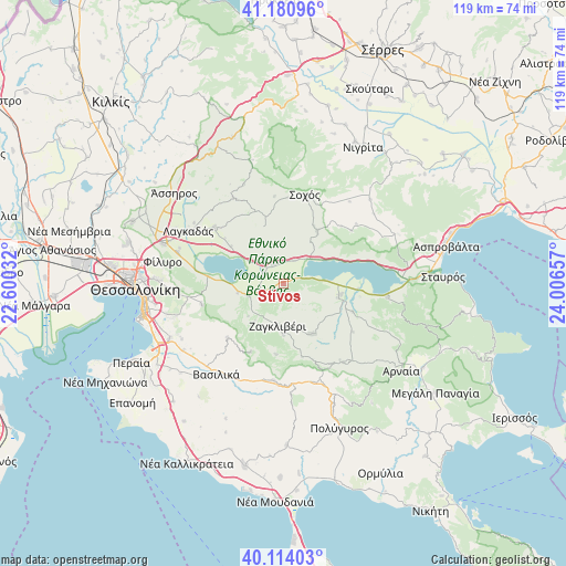
Stívos GPS coordinates[2]
40° 38' 58.668" North, 23° 18' 12.384" East
| Map corner | latitude | longitude |
|---|---|---|
| Upper-left | 41.18096°, | 22.60032° |
| Center: | 40.64963°, | 23.30344° |
| Lower-right: | 40.11403°, | 24.00657° |
| Map W x H: | 118.6×118.6 km | = 73.7×73.7mi |
| max Lat: | 41.72048° ⇑20.6% North |
| Stívos: | 40.64963° |
| min Lat: | ⇓79.4% South 34.8346° |
| min Long | Stívos | max Long |
| 19.40494° | 23.30344° | 29.59361° |
| W 60.4%⇐ | ⇒39.6% E |
Elevation
Elevation of Stívos is 142 m = 466 ft, and this is 26.9 m = 88 ft below average elevation for this country.
| Max E: |
1439 m = 4721 ft | 34.5% |
| Avg. | 168.9 m = 554 ft | |
| Stívos | 142 m = 466 ft | |
Min E: |
0 m = 0 ft | 65.5% |
See also: Greece elevation on elevation.city.
Geographical zone
Stívos is located in North temperate zone (between Tropic of Cancer and the Arctic Circle). Distance of this Northern Tropic circle is 1913.9 km =1189.2 mi to South.| Distance of | km | miles | from Stívos |
|---|---|---|---|
| North Pole | 5487.2 | 3409.6 | to North |
| Arctic Circle | 2881.4 | 1790.4 | to North |
| Tropic Cancer | 1913.9 | 1189.2 | to South |
| Equator | 4519.8 | 2808.5 | to South |


Nearby cities:
15 places around Stívos: (largest is in red/bold)
• Askós
13.3 km =8.3 mi,  32°
32°
• Chortiátis
17.7 km =11 mi,  255°
255°
• Galátista
20.3 km =12.6 mi,  185°
185°
• Gerakaroú
7.8 km =4.8 mi,  250°
250°
• Kalamotó
12 km =7.5 mi,  150°
150°
• Kolchikón
18.6 km =11.6 mi,  309°
309°
• Kryonéri
18.5 km =11.5 mi,  354°
354°
• Lagkadikia
5 km =3.1 mi, 252°
• Nikomidinó
2.7 km =1.7 mi,  238°
238°
• Néa Apollonía
11.9 km =7.4 mi,  102°
102°
• Peristerá
16.2 km =10.1 mi,  226°
226°
• Profítis
4.8 km =3 mi,  332°
332°
• Sochós
19.2 km =11.9 mi,  13°
13°
• Vasiloúdi
9.7 km =6 mi, 258°
• Ágios Vasíleios
16.1 km =10 mi,  275°
275°
Sources, notices
• [Note1] Compared only with cities in Greece existing in our database
• [Src1] Map data: © OpenStreetMap contributors (CC-BY-SA)
• [Src2] Other city data from geonames.org with taken over terms of usage.
• [Src3] Geographical zone / Annual Mean Temperature by Robert A. Rohde @ Wikipedia
