Gerakaroú geodata
Gerakaroú (Central Macedonia) is a populated place; located in Greece in Europe/Athens (GMT+3) time zone. With population of 1,293 people, there are 779 cities with bigger population in this country. Compared to other cities in Greece, 78.5% of cities are located further ↓South; 58.8% of cities are located further ←West and 64.7% of cities have lower elevation than Gerakaroú. Note1
Administrative division(s):
- Level 1: Central Macedonia
- Level 2: Nomós Thessaloníkis
- Level 3: Dimos Lagkadas


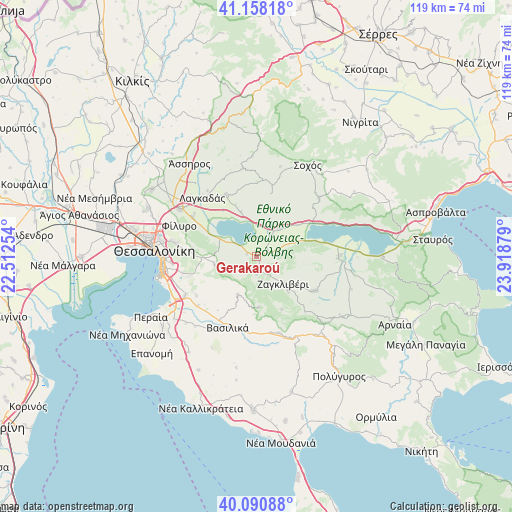
Gerakaroú GPS coordinates[2]
40° 37' 35.976" North, 23° 12' 56.376" East
| Map corner | latitude | longitude |
|---|---|---|
| Upper-left | 41.15818°, | 22.51254° |
| Center: | 40.62666°, | 23.21566° |
| Lower-right: | 40.09088°, | 23.91879° |
| Map W x H: | 118.7×118.7 km | = 73.8×73.8mi |
| max Lat: | 41.72048° ⇑21.5% North |
| Gerakaroú: | 40.62666° |
| min Lat: | ⇓78.5% South 34.8346° |
| min Long | Gerakaroú | max Long |
| 19.40494° | 23.21566° | 29.59361° |
| W 58.8%⇐ | ⇒41.2% E |
Elevation
Elevation of Gerakaroú is 139 m = 456 ft, and this is 29.9 m = 98 ft below average elevation for this country.
| Max E: |
1439 m = 4721 ft | 35.3% |
| Avg. | 168.9 m = 554 ft | |
| Gerakaroú | 139 m = 456 ft | |
Min E: |
0 m = 0 ft | 64.7% |
See also: Greece elevation on elevation.city.
Geographical zone
Gerakaroú is located in North temperate zone (between Tropic of Cancer and the Arctic Circle). Distance of this Northern Tropic circle is 1911.3 km =1187.6 mi to South.| Distance of | km | miles | from Gerakaroú |
|---|---|---|---|
| North Pole | 5489.8 | 3411.2 | to North |
| Arctic Circle | 2883.9 | 1792 | to North |
| Tropic Cancer | 1911.3 | 1187.6 | to South |
| Equator | 4517.3 | 2806.9 | to South |


Nearby cities:
15 places around Gerakaroú: (largest is in red/bold)
• Asvestochóri
16.1 km =10 mi,  275°
275°
• Chortiátis
9.9 km =6.2 mi,  258°
258°
• Galátista
18.4 km =11.4 mi,  162°
162°
• Kalamotó
15.5 km =9.6 mi,  120°
120°
• Kavallári
17.4 km =10.8 mi,  304°
304°
• Kolchikón
16 km =9.9 mi,  334°
334°
• Lagkadikia
2.8 km =1.7 mi,  68°
68°
• Nikomidinó
5.2 km =3.2 mi,  77°
77°
• Panórama
16.1 km =10 mi,  254°
254°
• Peristerá
9.6 km =6 mi,  206°
206°
• Profítis
8.6 km =5.3 mi,  37°
37°
• Stívos
7.8 km =4.8 mi, 70°
• Vasiliká
17.6 km =10.9 mi,  202°
202°
• Vasiloúdi
2.2 km =1.4 mi,  285°
285°
• Ágios Vasíleios
9.6 km =6 mi, 295°
Sources, notices
• [Note1] Compared only with cities in Greece existing in our database
• [Src1] Map data: © OpenStreetMap contributors (CC-BY-SA)
• [Src2] Other city data from geonames.org with taken over terms of usage.
• [Src3] Geographical zone / Annual Mean Temperature by Robert A. Rohde @ Wikipedia
