Vasiloúdi geodata
Vasiloúdi (Central Macedonia) is a populated place; located in Greece in Europe/Athens (GMT+3) time zone. With population of 681 people, there are 1441 cities with bigger population in this country. Compared to other cities in Greece, 78.7% of cities are located further ↓South; 58.4% of cities are located further ←West and 65.5% of cities have lower elevation than Vasiloúdi. Note1
Administrative division(s):
- Level 1: Central Macedonia
- Level 2: Nomós Thessaloníkis
- Level 3: Dimos Lagkadas


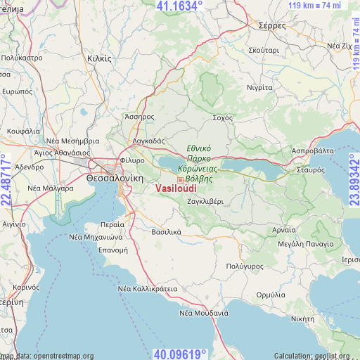
Vasiloúdi GPS coordinates[2]
40° 37' 54.948" North, 23° 11' 25.044" East
| Map corner | latitude | longitude |
|---|---|---|
| Upper-left | 41.1634°, | 22.48717° |
| Center: | 40.63193°, | 23.19029° |
| Lower-right: | 40.09619°, | 23.89342° |
| Map W x H: | 118.7×118.7 km | = 73.8×73.8mi |
| max Lat: | 41.72048° ⇑21.3% North |
| Vasiloúdi: | 40.63193° |
| min Lat: | ⇓78.7% South 34.8346° |
| min Long | Vasiloúdi | max Long |
| 19.40494° | 23.19029° | 29.59361° |
| W 58.4%⇐ | ⇒41.6% E |
Elevation
Elevation of Vasiloúdi is 142 m = 466 ft, and this is 26.9 m = 88 ft below average elevation for this country.
| Max E: |
1439 m = 4721 ft | 34.5% |
| Avg. | 168.9 m = 554 ft | |
| Vasiloúdi | 142 m = 466 ft | |
Min E: |
0 m = 0 ft | 65.5% |
See also: Greece elevation on elevation.city.
Geographical zone
Vasiloúdi is located in North temperate zone (between Tropic of Cancer and the Arctic Circle). Distance of this Northern Tropic circle is 1911.9 km =1188 mi to South.| Distance of | km | miles | from Vasiloúdi |
|---|---|---|---|
| North Pole | 5489.2 | 3410.8 | to North |
| Arctic Circle | 2883.3 | 1791.6 | to North |
| Tropic Cancer | 1911.9 | 1188 | to South |
| Equator | 4517.8 | 2807.2 | to South |


Nearby cities:
15 places around Vasiloúdi: (largest is in red/bold)
• Asvestochóri
14 km =8.7 mi,  274°
274°
• Chortiátis
8 km =5 mi,  251°
251°
• Fíliro
17 km =10.6 mi,  292°
292°
• Gerakaroú
2.2 km =1.4 mi,  105°
105°
• Kavallári
15.3 km =9.5 mi,  307°
307°
• Kolchikón
14.7 km =9.1 mi,  341°
341°
• Lagkadikia
4.8 km =3 mi,  84°
84°
• Lagkadás
16.8 km =10.4 mi,  321°
321°
• Nikomidinó
7.2 km =4.5 mi,  85°
85°
• Panórama
14.3 km =8.9 mi, 249°
• Peristerá
9.5 km =5.9 mi,  192°
192°
• Profítis
9.6 km =6 mi,  49°
49°
• Péfka
16.8 km =10.4 mi,  279°
279°
• Stívos
9.7 km =6 mi, 78°
• Ágios Vasíleios
7.4 km =4.6 mi,  299°
299°
Sources, notices
• [Note1] Compared only with cities in Greece existing in our database
• [Src1] Map data: © OpenStreetMap contributors (CC-BY-SA)
• [Src2] Other city data from geonames.org with taken over terms of usage.
• [Src3] Geographical zone / Annual Mean Temperature by Robert A. Rohde @ Wikipedia
