Galátista geodata
Galátista (Central Macedonia) is a populated place; located in Greece in Europe/Athens (GMT+3) time zone. With population of 2,537 people, there are 414 cities with bigger population in this country. Compared to other cities in Greece, 73.2% of cities are located further ↓South; 59.8% of cities are located further ←West and 87.6% of cities have lower elevation than Galátista. Note1
Administrative division(s):
- Level 1: Central Macedonia
- Level 2: Nomós Chalkidikís
- Level 3: Dimos Polygyros


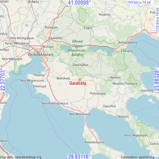
Galátista GPS coordinates[2]
40° 28' 5.52" North, 23° 16' 48.54" East
| Map corner | latitude | longitude |
|---|---|---|
| Upper-left | 41.00098°, | 22.57703° |
| Center: | 40.4682°, | 23.28015° |
| Lower-right: | 39.93116°, | 23.98328° |
| Map W x H: | 119×119 km | = 73.9×73.9mi |
| max Lat: | 41.72048° ⇑26.8% North |
| Galátista: | 40.4682° |
| min Lat: | ⇓73.2% South 34.8346° |
| min Long | Galátista | max Long |
| 19.40494° | 23.28015° | 29.59361° |
| W 59.8%⇐ | ⇒40.2% E |
Elevation
Elevation of Galátista is 449 m = 1473 ft, and this is 280.1 m = 919 ft above average elevation for this country.
| Max E: |
1439 m = 4721 ft | 12.4% |
| Galátista | 449 m 1473 ft | |
| Avg. | 168.9 m = 554 ft | |
Min E: |
0 m = 0 ft | 87.6% |
See also: Greece elevation on elevation.city.
Geographical zone
Galátista is located in North temperate zone (between Tropic of Cancer and the Arctic Circle). Distance of this Northern Tropic circle is 1893.7 km =1176.7 mi to South.| Distance of | km | miles | from Galátista |
|---|---|---|---|
| North Pole | 5507.4 | 3422.1 | to North |
| Arctic Circle | 2901.5 | 1802.9 | to North |
| Tropic Cancer | 1893.7 | 1176.7 | to South |
| Equator | 4499.6 | 2795.9 | to South |


Nearby cities:
15 places around Galátista: (largest is in red/bold)
• Agía Paraskeví
19.6 km =12.2 mi,  274°
274°
• Gerakaroú
18.4 km =11.4 mi,  342°
342°
• Kalamotó
12.6 km =7.8 mi,  38°
38°
• Lagkadikia
18.8 km =11.7 mi,  351°
351°
• Nikomidinó
18.8 km =11.7 mi,  358°
358°
• Néa Sílata
19.8 km =12.3 mi,  218°
218°
• Néa Tríglia
19.1 km =11.9 mi,  199°
199°
• Palaiochóra
14.9 km =9.3 mi,  75°
75°
• Peristerá
13.2 km =8.2 mi,  312°
312°
• Polýgyros
17 km =10.6 mi,  126°
126°
• Sourotí
15.9 km =9.9 mi, 271°
• Stívos
20.3 km =12.6 mi,  5°
5°
• Símantra
13.9 km =8.6 mi,  169°
169°
• Vasiliká
12.2 km =7.6 mi,  276°
276°
• Vasiloúdi
19.7 km =12.2 mi, 337°
Sources, notices
• [Note1] Compared only with cities in Greece existing in our database
• [Src1] Map data: © OpenStreetMap contributors (CC-BY-SA)
• [Src2] Other city data from geonames.org with taken over terms of usage.
• [Src3] Geographical zone / Annual Mean Temperature by Robert A. Rohde @ Wikipedia
