Peristerá geodata
Peristerá (Central Macedonia) is a populated place; located in Greece in Europe/Athens (GMT+3) time zone. With population of 1,137 people, there are 882 cities with bigger population in this country. Compared to other cities in Greece, 76% of cities are located further ↓South; 58.1% of cities are located further ←West and 92.2% of cities have lower elevation than Peristerá. Note1
Administrative division(s):
- Level 1: Central Macedonia
- Level 2: Nomós Thessaloníkis
- Level 3: Dimos Thermi


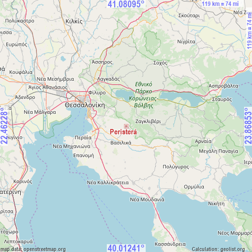
Peristerá GPS coordinates[2]
40° 32' 55.716" North, 23° 9' 55.44" East
| Map corner | latitude | longitude |
|---|---|---|
| Upper-left | 41.08095°, | 22.46228° |
| Center: | 40.54881°, | 23.1654° |
| Lower-right: | 40.01241°, | 23.86853° |
| Map W x H: | 118.8×118.8 km | = 73.8×73.8mi |
| max Lat: | 41.72048° ⇑24% North |
| Peristerá: | 40.54881° |
| min Lat: | ⇓76% South 34.8346° |
| min Long | Peristerá | max Long |
| 19.40494° | 23.1654° | 29.59361° |
| W 58.1%⇐ | ⇒41.9% E |
Elevation
Elevation of Peristerá is 577 m = 1893 ft, and this is 408.1 m = 1339 ft above average elevation for this country.
| Max E: |
1439 m = 4721 ft | 7.8% |
| Peristerá | 577 m 1893 ft | |
| Avg. | 168.9 m = 554 ft | |
Min E: |
0 m = 0 ft | 92.2% |
See also: Greece elevation on elevation.city.
Geographical zone
Peristerá is located in North temperate zone (between Tropic of Cancer and the Arctic Circle). Distance of this Northern Tropic circle is 1902.7 km =1182.3 mi to South.| Distance of | km | miles | from Peristerá |
|---|---|---|---|
| North Pole | 5498.5 | 3416.6 | to North |
| Arctic Circle | 2892.6 | 1797.4 | to North |
| Tropic Cancer | 1902.7 | 1182.3 | to South |
| Equator | 4508.6 | 2801.5 | to South |


Nearby cities:
15 places around Peristerá: (largest is in red/bold)
• Agía Paraskeví
12.4 km =7.7 mi,  232°
232°
• Asvestochóri
15.7 km =9.8 mi,  310°
310°
• Chortiátis
8.7 km =5.4 mi,  320°
320°
• Galátista
13.2 km =8.2 mi,  132°
132°
• Gerakaroú
9.6 km =6 mi,  26°
26°
• Lagkadikia
11.8 km =7.3 mi,  35°
35°
• Nikomidinó
13.5 km =8.4 mi, 43°
• Néo Rýsi
16.1 km =10 mi,  248°
248°
• Panórama
12.1 km =7.5 mi,  290°
290°
• Pylaía
16.1 km =10 mi, 290°
• Sourotí
10.5 km =6.5 mi,  216°
216°
• Thérmi
12.3 km =7.6 mi,  269°
269°
• Vasiliká
8.1 km =5 mi,  197°
197°
• Vasiloúdi
9.5 km =5.9 mi,  12°
12°
• Ágios Vasíleios
13.6 km =8.5 mi,  341°
341°
Sources, notices
• [Note1] Compared only with cities in Greece existing in our database
• [Src1] Map data: © OpenStreetMap contributors (CC-BY-SA)
• [Src2] Other city data from geonames.org with taken over terms of usage.
• [Src3] Geographical zone / Annual Mean Temperature by Robert A. Rohde @ Wikipedia
