Siátista geodata
Siátista (West Macedonia) is a seat of a third-order administrative division; located in Greece in Europe/Athens (GMT+3) time zone. With population of 5,612 people, there are 216 cities with bigger population in this country. Compared to other cities in Greece, 69.4% of cities are located further ↓South; 82.2% of cities are located further →East and 99.2% of cities have lower elevation than Siátista. Note1


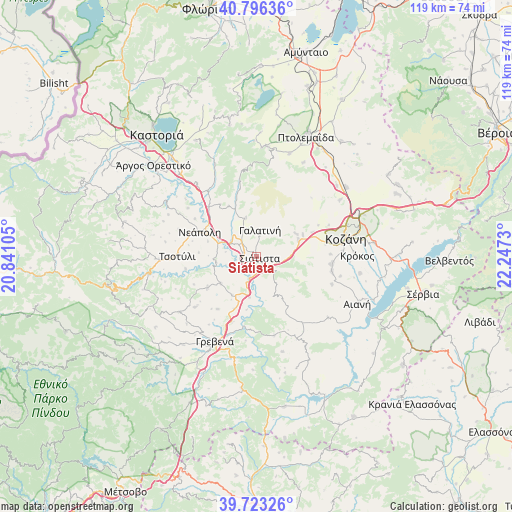
Siátista GPS coordinates[2]
40° 15' 42.984" North, 21° 32' 39.012" East
| Map corner | latitude | longitude |
|---|---|---|
| Upper-left | 40.79636°, | 20.84105° |
| Center: | 40.26194°, | 21.54417° |
| Lower-right: | 39.72326°, | 22.2473° |
| Map W x H: | 119.3×119.3 km | = 74.1×74.1mi |
| max Lat: | 41.72048° ⇑30.6% North |
| Siátista: | 40.26194° |
| min Lat: | ⇓69.4% South 34.8346° |
| min Long | Siátista | max Long |
| 19.40494° | 21.54417° | 29.59361° |
| W 17.8%⇐ | ⇒82.2% E |
Elevation
Elevation of Siátista is 948 m = 3110 ft, and this is 779.1 m = 2556 ft above average elevation for this country.
| Max E: |
1439 m = 4721 ft | 0.8% |
| Siátista | 948 m 3110 ft | |
| Avg. | 168.9 m = 554 ft | |
Min E: |
0 m = 0 ft | 99.2% |
See also: Greece elevation on elevation.city.
Geographical zone
Siátista is located in North temperate zone (between Tropic of Cancer and the Arctic Circle). Distance of this Northern Tropic circle is 1870.8 km =1162.5 mi to South.| Distance of | km | miles | from Siátista |
|---|---|---|---|
| North Pole | 5530.4 | 3436.4 | to North |
| Arctic Circle | 2924.5 | 1817.2 | to North |
| Tropic Cancer | 1870.8 | 1162.5 | to South |
| Equator | 4476.7 | 2781.7 | to South |


Nearby cities:
15 places around Siátista: (largest is in red/bold)
• Aianí
25.8 km =16 mi,  115°
115°
• Anaráchi
25.7 km =16 mi,  5°
5°
• Empório
25.2 km =15.7 mi,  2°
2°
• Erátyra
9.3 km =5.8 mi,  343°
343°
• Galatiní
6.4 km =4 mi, 5°
• Grevená
22.1 km =13.7 mi,  206°
206°
• Gérmas
23.6 km =14.7 mi, 335°
• Kozáni
21.2 km =13.2 mi,  78°
78°
• Koíla
22.3 km =13.9 mi,  69°
69°
• Krókos
23.2 km =14.4 mi,  89°
89°
• Néo Kostarázi
26.4 km =16.4 mi,  316°
316°
• Tsotíli
18.6 km =11.6 mi,  269°
269°
• Vogatsikó
21.9 km =13.6 mi, 320°
• Áno Kómi
24.4 km =15.2 mi,  99°
99°
• Árdassa
25.1 km =15.6 mi,  17°
17°
Sources, notices
• [Note1] Compared only with cities in Greece existing in our database
• [Src1] Map data: © OpenStreetMap contributors (CC-BY-SA)
• [Src2] Other city data from geonames.org with taken over terms of usage.
• [Src3] Geographical zone / Annual Mean Temperature by Robert A. Rohde @ Wikipedia
