Fteliá geodata
Fteliá (East Macedonia and Thrace) is a populated place; located in Greece in Europe/Athens (GMT+3) time zone. With population of 1,006 people, there are 1008 cities with bigger population in this country. Compared to other cities in Greece, 94.8% of cities are located further ↓South; 81% of cities are located further ←West and 50.9% of cities have higher elevation than Fteliá. Note1
Administrative division(s):
- Level 1: East Macedonia and Thrace
- Level 2: Nomós Drámas
- Level 3: Dimos Doxato


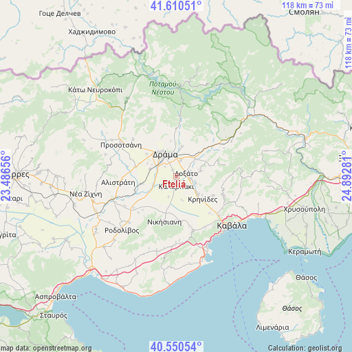
Fteliá GPS coordinates[2]
41° 4' 57.576" North, 24° 11' 22.848" East
| Map corner | latitude | longitude |
|---|---|---|
| Upper-left | 41.61051°, | 23.48656° |
| Center: | 41.08266°, | 24.18968° |
| Lower-right: | 40.55054°, | 24.89281° |
| Map W x H: | 117.9×117.9 km | = 73.3×73.3mi |
| max Lat: | 41.72048° ⇑5.2% North |
| Fteliá: | 41.08266° |
| min Lat: | ⇓94.8% South 34.8346° |
| min Long | Fteliá | max Long |
| 19.40494° | 24.18968° | 29.59361° |
| W 81%⇐ | ⇒19% E |
Elevation
Elevation of Fteliá is 78 m = 256 ft, and this is 90.9 m = 298 ft below average elevation for this country.
| Max E: |
1439 m = 4721 ft | 50.9% |
| Avg. | 168.9 m = 554 ft | |
| Fteliá | 78 m = 256 ft | |
Min E: |
0 m = 0 ft | 49.1% |
See also: Greece elevation on elevation.city.
Geographical zone
Fteliá is located in North temperate zone (between Tropic of Cancer and the Arctic Circle). Distance of this Northern Tropic circle is 1962 km =1219.1 mi to South.| Distance of | km | miles | from Fteliá |
|---|---|---|---|
| North Pole | 5439.1 | 3379.7 | to North |
| Arctic Circle | 2833.2 | 1760.5 | to North |
| Tropic Cancer | 1962 | 1219.1 | to South |
| Equator | 4568 | 2838.4 | to South |


Nearby cities:
15 places around Fteliá: (largest is in red/bold)
• Antifílippoi
15.3 km =9.5 mi,  173°
173°
• Choristí
5.6 km =3.5 mi,  16°
16°
• Dráma
8.6 km =5.3 mi,  335°
335°
• Fotolívos
12.2 km =7.6 mi,  258°
258°
• Fílippoi
14.1 km =8.8 mi,  117°
117°
• Georgianí
14.4 km =8.9 mi,  193°
193°
• Kalampáki
3.7 km =2.3 mi, 188°
• Kallífytos
10.2 km =6.3 mi,  12°
12°
• Kalós Agrós
9.1 km =5.7 mi,  286°
286°
• Krinídes
11.8 km =7.3 mi,  130°
130°
• Kýria
8.5 km =5.3 mi,  77°
77°
• Lydía
9.6 km =6 mi, 126°
• Sitagroí
13.9 km =8.6 mi,  282°
282°
• Xiropótamos
14.1 km =8.8 mi,  329°
329°
• Ágios Athanásios
4.8 km =3 mi,  100°
100°
Sources, notices
• [Note1] Compared only with cities in Greece existing in our database
• [Src1] Map data: © OpenStreetMap contributors (CC-BY-SA)
• [Src2] Other city data from geonames.org with taken over terms of usage.
• [Src3] Geographical zone / Annual Mean Temperature by Robert A. Rohde @ Wikipedia
