Santa Cruz Balanyá geodata
Santa Cruz Balanyá (Chimaltenango) is a seat of a second-order administrative division; located in Guatemala in America/Guatemala (GMT-6) time zone. With population of 7,825 people, there are 159 cities with bigger population in this country. Compared to other cities in Guatemala, 61.7% of cities are located further ↑North; 51% of cities are located further ←West and 77% of cities have lower elevation than Santa Cruz Balanyá. Note1


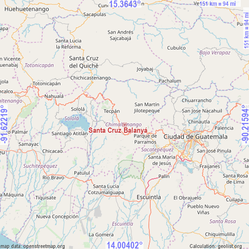
Santa Cruz Balanyá GPS coordinates[2]
14° 41' 6.792" North, 90° 55' 8.616" West
| Map corner | latitude | longitude |
|---|---|---|
| Upper-left | 15.3643°, | -91.62219° |
| Center: | 14.68522°, | -90.91906° |
| Lower-right: | 14.00402°, | -90.21594° |
| Map W x H: | 151.2×151.3 km | = 94×94mi |
| max Lat: | 17.06606° ⇑61.7% North |
| Santa Cruz Balanyá: | 14.68522° |
| min Lat: | ⇓38.3% South 13.9274° |
| min Long | Santa Cruz Bala | max Long |
| -92.19298° | -90.91906° | -88.59444° |
| W 51%⇐ | ⇒49% E |
Elevation
Elevation of Santa Cruz Balanyá is 2036 m = 6680 ft, and this is 769 m = 2523 ft above average elevation for this country.
| Max E: |
3254 m = 10676 ft | 23% |
| Santa Cruz Balanyá | 2036 m 6680 ft | |
| Avg. | 1267 m = 4157 ft | |
Min E: |
1 m = 3 ft | 77% |
See also: Guatemala elevation on elevation.city.
Geographical zone
Santa Cruz Balanyá is located in North Torrid zone (between Equator and Tropic of Cancer). Distance of this Northern Tropic circle is 973.1 km =604.7 mi to North.| Distance of | km | miles | from Santa Cruz Balanyá |
|---|---|---|---|
| North Pole | 8374.2 | 5203.5 | to North |
| Arctic Circle | 5768.3 | 3584.3 | to North |
| Tropic Cancer | 973.1 | 604.7 | to North |
| Equator | 1632.8 | 1014.6 | to South |


Nearby cities:
15 places around Santa Cruz Balanyá: (largest is in red/bold)
• Acatenango
14.8 km =9.2 mi,  190°
190°
• Chimaltenango
11 km =6.8 mi,  104°
104°
• Comalapa
7.1 km =4.4 mi,  28°
28°
• El Tejar
14.4 km =8.9 mi,  107°
107°
• Parramos
15.1 km =9.4 mi,  124°
124°
• Pastores
20.4 km =12.7 mi, 119°
• Patzicía
6 km =3.7 mi, 187°
• Patzún
10.2 km =6.3 mi,  267°
267°
• San Andrés Itzapa
10.8 km =6.7 mi,  130°
130°
• San José Poaquil
14.8 km =9.2 mi,  2°
2°
• San Martín Jilotepeque
17.2 km =10.7 mi,  52°
52°
• Santa Apolonia
13 km =8.1 mi,  333°
333°
• Sumpango
20.3 km =12.6 mi, 102°
• Tecpán Guatemala
11.6 km =7.2 mi,  317°
317°
• Zaragoza
5 km =3.1 mi,  141°
141°
Sources, notices
• [Note1] Compared only with cities in Guatemala existing in our database
• [Src1] Map data: © OpenStreetMap contributors (CC-BY-SA)
• [Src2] Other city data from geonames.org with taken over terms of usage.
• [Src3] Geographical zone / Annual Mean Temperature by Robert A. Rohde @ Wikipedia
