San José Poaquil geodata
San José Poaquil (Chimaltenango) is a seat of a second-order administrative division; located in Guatemala in America/Guatemala (GMT-6) time zone. With population of 5,987 people, there are 189 cities with bigger population in this country. Compared to other cities in Guatemala, 51.6% of cities are located further ↓South; 51.3% of cities are located further ←West and 73.7% of cities have lower elevation than San José Poaquil. Note1


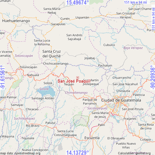
San José Poaquil GPS coordinates[2]
14° 49' 5.088" North, 90° 54' 44.928" West
| Map corner | latitude | longitude |
|---|---|---|
| Upper-left | 15.49674°, | -91.61561° |
| Center: | 14.81808°, | -90.91248° |
| Lower-right: | 14.13729°, | -90.20936° |
| Map W x H: | 151.2×151.2 km | = 94×94mi |
| max Lat: | 17.06606° ⇑48.4% North |
| San José Poaquil: | 14.81808° |
| min Lat: | ⇓51.6% South 13.9274° |
| min Long | San José Poaqu | max Long |
| -92.19298° | -90.91248° | -88.59444° |
| W 51.3%⇐ | ⇒48.7% E |
Elevation
Elevation of San José Poaquil is 1936 m = 6352 ft, and this is 669 m = 2195 ft above average elevation for this country.
| Max E: |
3254 m = 10676 ft | 26.3% |
| San José Poaquil | 1936 m 6352 ft | |
| Avg. | 1267 m = 4157 ft | |
Min E: |
1 m = 3 ft | 73.7% |
See also: Guatemala elevation on elevation.city.
Geographical zone
San José Poaquil is located in North Torrid zone (between Equator and Tropic of Cancer). Distance of this Northern Tropic circle is 958.3 km =595.5 mi to North.| Distance of | km | miles | from San José Poaquil |
|---|---|---|---|
| North Pole | 8359.4 | 5194.3 | to North |
| Arctic Circle | 5753.6 | 3575.1 | to North |
| Tropic Cancer | 958.3 | 595.5 | to North |
| Equator | 1647.6 | 1023.8 | to South |


Nearby cities:
15 places around San José Poaquil: (largest is in red/bold)
• Chimaltenango
20.1 km =12.5 mi,  150°
150°
• Comalapa
9 km =5.6 mi,  162°
162°
• Concepción
25.5 km =15.8 mi,  261°
261°
• El Tejar
23.1 km =14.4 mi, 145°
• Joyabaj
22.8 km =14.2 mi,  31°
31°
• Patzicía
20.8 km =12.9 mi,  184°
184°
• Patzún
18.7 km =11.6 mi,  215°
215°
• San Andrés Itzapa
23 km =14.3 mi, 161°
• San Andrés Semetabaj
25.1 km =15.6 mi,  251°
251°
• San Martín Jilotepeque
13.6 km =8.5 mi,  108°
108°
• Santa Apolonia
7.2 km =4.5 mi,  244°
244°
• Santa Cruz Balanyá
14.8 km =9.2 mi, 182°
• Tecpán Guatemala
10.6 km =6.6 mi,  233°
233°
• Zacualpa
23.5 km =14.6 mi,  9°
9°
• Zaragoza
18.9 km =11.7 mi,  172°
172°
Sources, notices
• [Note1] Compared only with cities in Guatemala existing in our database
• [Src1] Map data: © OpenStreetMap contributors (CC-BY-SA)
• [Src2] Other city data from geonames.org with taken over terms of usage.
• [Src3] Geographical zone / Annual Mean Temperature by Robert A. Rohde @ Wikipedia
