Almolonga geodata
Almolonga (Quetzaltenango) is a seat of a second-order administrative division; located in Guatemala in America/Guatemala (GMT-6) time zone. With population of 11,913 people, there are 107 cities with bigger population in this country. Compared to other cities in Guatemala, 51% of cities are located further ↓South; 72.6% of cities are located further →East and 87% of cities have lower elevation than Almolonga. Note1


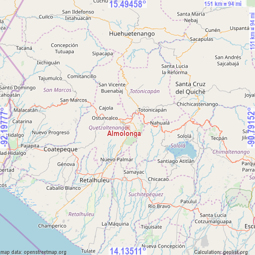
Almolonga GPS coordinates[2]
14° 48' 57.276" North, 91° 29' 40.704" West
| Map corner | latitude | longitude |
|---|---|---|
| Upper-left | 15.49458°, | -92.19777° |
| Center: | 14.81591°, | -91.49464° |
| Lower-right: | 14.13511°, | -90.79152° |
| Map W x H: | 151.2×151.2 km | = 94×94mi |
| max Lat: | 17.06606° ⇑49% North |
| Almolonga: | 14.81591° |
| min Lat: | ⇓51% South 13.9274° |
| min Long | Almolonga | max Long |
| -92.19298° | -91.49464° | -88.59444° |
| W 27.4%⇐ | ⇒72.6% E |
Elevation
Elevation of Almolonga is 2322 m = 7618 ft, and this is 1055 m = 3461 ft above average elevation for this country.
| Max E: |
3254 m = 10676 ft | 13% |
| Almolonga | 2322 m 7618 ft | |
| Avg. | 1267 m = 4157 ft | |
Min E: |
1 m = 3 ft | 87% |
See also: Guatemala elevation on elevation.city.
Geographical zone
Almolonga is located in North Torrid zone (between Equator and Tropic of Cancer). Distance of this Northern Tropic circle is 958.5 km =595.6 mi to North.| Distance of | km | miles | from Almolonga |
|---|---|---|---|
| North Pole | 8359.7 | 5194.5 | to North |
| Arctic Circle | 5753.8 | 3575.2 | to North |
| Tropic Cancer | 958.5 | 595.6 | to North |
| Equator | 1647.4 | 1023.6 | to South |


Nearby cities:
15 places around Almolonga: (largest is in red/bold)
• Cantel
4.3 km =2.7 mi,  96°
96°
• Concepción Chiquirichapa
14.5 km =9 mi,  287°
287°
• La Esperanza
9.5 km =5.9 mi,  310°
310°
• Olintepeque
8.1 km =5 mi,  344°
344°
• Ostuncalco
14.8 km =9.2 mi, 293°
• Quetzaltenango
3.3 km =2.1 mi, 309°
• Salcajá
8.2 km =5.1 mi,  29°
29°
• San Andrés Xecul
10 km =6.2 mi,  7°
7°
• San Cristóbal Totonicapán
12.6 km =7.8 mi, 27°
• San Francisco El Alto
15.4 km =9.6 mi,  21°
21°
• San Francisco la Unión
13 km =8.1 mi, 337°
• San Mateo
11.3 km =7 mi, 294°
• San Miguel Sigüilá
15.6 km =9.7 mi,  304°
304°
• Santa Catarina Ixtahuacán
14.8 km =9.2 mi, 97°
• Zunil
3.7 km =2.3 mi,  160°
160°
Sources, notices
• [Note1] Compared only with cities in Guatemala existing in our database
• [Src1] Map data: © OpenStreetMap contributors (CC-BY-SA)
• [Src2] Other city data from geonames.org with taken over terms of usage.
• [Src3] Geographical zone / Annual Mean Temperature by Robert A. Rohde @ Wikipedia
