San Agustín Acasaguastlán geodata
San Agustín Acasaguastlán (El Progreso) is a seat of a second-order administrative division; located in Guatemala in America/Guatemala (GMT-6) time zone. With population of 10,335 people, there are 123 cities with bigger population in this country. Compared to other cities in Guatemala, 63.1% of cities are located further ↓South; 81.7% of cities are located further ←West and 82.3% of cities have higher elevation than San Agustín Acasaguastlán. Note1
Current local time in San Agustín Acasaguastlán:
02:38 PM, SundayDifference from your time zone: hours


San Agustín Acasaguastlán GPS coordinates[2]
14° 57' 0" North, 89° 58' 0.012" West
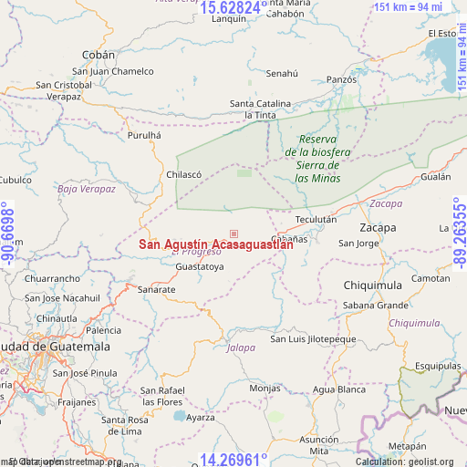
| Map corner | latitude | longitude |
|---|---|---|
| Upper-left | 15.62824°, | -90.6698° |
| Center: | 14.95°, | -89.96667° |
| Lower-right: | 14.26961°, | -89.26355° |
| Map W x H: | 151.1×151.1 km | = 93.9×93.9mi |
| max Lat: | 17.06606° ⇑36.9% North |
| San Agustín Acasaguastlán: | 14.95° |
| min Lat: | ⇓63.1% South 13.9274° |
| min Long | San Agustín Ac | max Long |
| -92.19298° | -89.96667° | -88.59444° |
| W 81.7%⇐ | ⇒18.3% E |
Elevation
Elevation of San Agustín Acasaguastlán is 327 m = 1073 ft, and this is 940 m = 3084 ft below average elevation for this country.
| Max E: |
3254 m = 10676 ft | 82.3% |
| Avg. | 1267 m = 4157 ft | |
| San Agustín Acasaguastlán | 327 m = 1073 ft | |
Min E: |
1 m = 3 ft | 17.7% |
See also: Guatemala elevation on elevation.city.
Geographical zone
San Agustín Acasaguastlán is located in North Torrid zone (between Equator and Tropic of Cancer). Distance of this Northern Tropic circle is 943.6 km =586.3 mi to North.| Distance of | km | miles | from San Agustín Acasaguastlán |
|---|---|---|---|
| North Pole | 8344.8 | 5185.2 | to North |
| Arctic Circle | 5738.9 | 3566 | to North |
| Tropic Cancer | 943.6 | 586.3 | to North |
| Equator | 1662.3 | 1032.9 | to South |


Nearby cities:
15 places around San Agustín Acasaguastlán: (largest is in red/bold)
• Cabañas
18 km =11.2 mi,  95°
95°
• El Jícaro
8.1 km =5 mi,  117°
117°
• Guastatoya
15.3 km =9.5 mi,  226°
226°
• Huité
26.9 km =16.7 mi,  93°
93°
• Jalapa
35.1 km =21.8 mi,  183°
183°
• Morazán
19 km =11.8 mi,  264°
264°
• San Antonio La Paz
40.3 km =25 mi,  238°
238°
• San Cristóbal Acasaguastlán
9.7 km =6 mi,  112°
112°
• San Diego
27 km =16.8 mi,  133°
133°
• San Jerónimo
31.9 km =19.8 mi,  292°
292°
• San Pedro Pinula
33.9 km =21.1 mi,  158°
158°
• Sanarate
30.7 km =19.1 mi, 234°
• Sansare
27.8 km =17.3 mi,  215°
215°
• Teculután
27.1 km =16.8 mi,  82°
82°
• Usumatlán
19.7 km =12.2 mi, 90°
Sources, notices
• [Note1] Compared only with cities in Guatemala existing in our database
• [Src1] Map data: © OpenStreetMap contributors (CC-BY-SA)
• [Src2] Other city data from geonames.org with taken over terms of usage.
• [Src3] Geographical zone / Annual Mean Temperature by Robert A. Rohde @ Wikipedia
