Cunén geodata
Cunén (Quiché) is a seat of a second-order administrative division; located in Guatemala in America/Guatemala (GMT-6) time zone. With population of 8,400 people, there are 152 cities with bigger population in this country. Compared to other cities in Guatemala, 80.8% of cities are located further ↓South; 52.5% of cities are located further →East and 71.1% of cities have lower elevation than Cunén. Note1


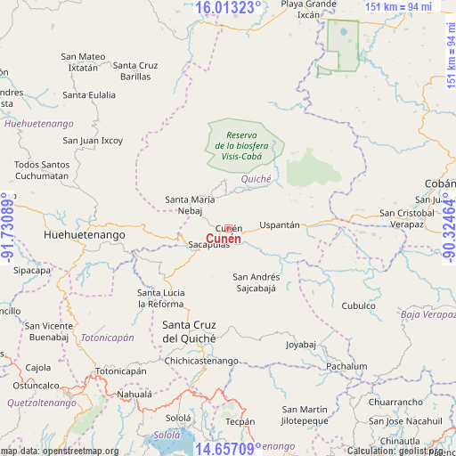
Cunén GPS coordinates[2]
15° 20' 10.536" North, 91° 1' 39.936" West
| Map corner | latitude | longitude |
|---|---|---|
| Upper-left | 16.01323°, | -91.73089° |
| Center: | 15.33626°, | -91.02776° |
| Lower-right: | 14.65709°, | -90.32464° |
| Map W x H: | 150.8×150.8 km | = 93.7×93.7mi |
| max Lat: | 17.06606° ⇑19.2% North |
| Cunén: | 15.33626° |
| min Lat: | ⇓80.8% South 13.9274° |
| min Long | Cunén | max Long |
| -92.19298° | -91.02776° | -88.59444° |
| W 47.5%⇐ | ⇒52.5% E |
Elevation
Elevation of Cunén is 1824 m = 5984 ft, and this is 557 m = 1827 ft above average elevation for this country.
| Max E: |
3254 m = 10676 ft | 28.9% |
| Cunén | 1824 m 5984 ft | |
| Avg. | 1267 m = 4157 ft | |
Min E: |
1 m = 3 ft | 71.1% |
See also: Guatemala elevation on elevation.city.
Geographical zone
Cunén is located in North Torrid zone (between Equator and Tropic of Cancer). Distance of this Northern Tropic circle is 900.7 km =559.7 mi to North.| Distance of | km | miles | from Cunén |
|---|---|---|---|
| North Pole | 8301.8 | 5158.5 | to North |
| Arctic Circle | 5695.9 | 3539.3 | to North |
| Tropic Cancer | 900.7 | 559.7 | to North |
| Equator | 1705.2 | 1059.6 | to South |


Nearby cities:
15 places around Cunén: (largest is in red/bold)
• Aguacatán
30.4 km =18.9 mi,  271°
271°
• Canillá
26.7 km =16.6 mi,  135°
135°
• Chajul
16.6 km =10.3 mi,  357°
357°
• Chicamán
24.5 km =15.2 mi,  86°
86°
• Chiché
36.6 km =22.7 mi,  186°
186°
• Chinique
32.8 km =20.4 mi,  179°
179°
• Nebaj
14.9 km =9.3 mi,  301°
301°
• Sacapulas
8.5 km =5.3 mi,  230°
230°
• San Andrés Sajcabajá
20 km =12.4 mi,  152°
152°
• San Bartolomé Jocotenango
17 km =10.6 mi,  198°
198°
• San Juan Cotzal
10.9 km =6.8 mi, 356°
• San Pédro Jocopilas
29.9 km =18.6 mi,  206°
206°
• Santa Cruz del Quiché
36.4 km =22.6 mi, 200°
• Santa Lucia La Reforma
32.2 km =20 mi,  224°
224°
• Uspantán
16.9 km =10.5 mi, 86°
Sources, notices
• [Note1] Compared only with cities in Guatemala existing in our database
• [Src1] Map data: © OpenStreetMap contributors (CC-BY-SA)
• [Src2] Other city data from geonames.org with taken over terms of usage.
• [Src3] Geographical zone / Annual Mean Temperature by Robert A. Rohde @ Wikipedia
