Chiché geodata
Chiché (Quiché) is a seat of a second-order administrative division; located in Guatemala in America/Guatemala (GMT-6) time zone. With population of 2,406 people, there are 263 cities with bigger population in this country. Compared to other cities in Guatemala, 67.3% of cities are located further ↓South; 53.7% of cities are located further →East and 75.5% of cities have lower elevation than Chiché. Note1


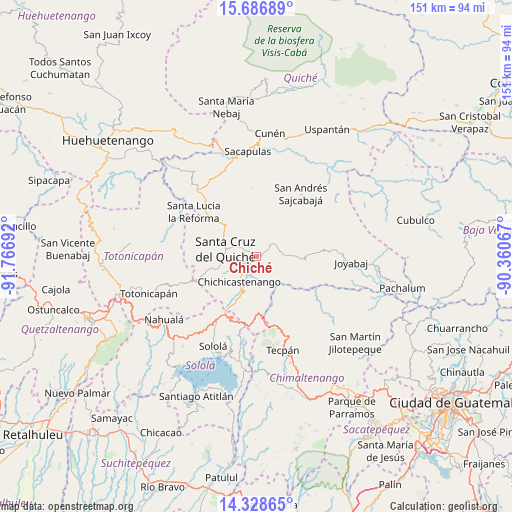
Chiché GPS coordinates[2]
15° 0' 31.86" North, 91° 3' 49.644" West
| Map corner | latitude | longitude |
|---|---|---|
| Upper-left | 15.68689°, | -91.76692° |
| Center: | 15.00885°, | -91.06379° |
| Lower-right: | 14.32865°, | -90.36067° |
| Map W x H: | 151×151 km | = 93.8×93.8mi |
| max Lat: | 17.06606° ⇑32.7% North |
| Chiché: | 15.00885° |
| min Lat: | ⇓67.3% South 13.9274° |
| min Long | Chiché | max Long |
| -92.19298° | -91.06379° | -88.59444° |
| W 46.3%⇐ | ⇒53.7% E |
Elevation
Elevation of Chiché is 2009 m = 6591 ft, and this is 742 m = 2434 ft above average elevation for this country.
| Max E: |
3254 m = 10676 ft | 24.5% |
| Chiché | 2009 m 6591 ft | |
| Avg. | 1267 m = 4157 ft | |
Min E: |
1 m = 3 ft | 75.5% |
See also: Guatemala elevation on elevation.city.
Geographical zone
Chiché is located in North Torrid zone (between Equator and Tropic of Cancer). Distance of this Northern Tropic circle is 937.1 km =582.3 mi to North.| Distance of | km | miles | from Chiché |
|---|---|---|---|
| North Pole | 8338.2 | 5181.1 | to North |
| Arctic Circle | 5732.3 | 3561.9 | to North |
| Tropic Cancer | 937.1 | 582.3 | to North |
| Equator | 1668.8 | 1036.9 | to South |


Nearby cities:
15 places around Chiché: (largest is in red/bold)
• Chichicastenango
8.9 km =5.5 mi,  214°
214°
• Chinique
5.4 km =3.4 mi,  48°
48°
• Concepción
26.6 km =16.5 mi,  199°
199°
• Joyabaj
28.2 km =17.5 mi,  93°
93°
• Patzité
16.3 km =10.1 mi,  252°
252°
• San Andrés Sajcabajá
22.7 km =14.1 mi,  35°
35°
• San Antonio Ilotenango
18.5 km =11.5 mi,  285°
285°
• San Bartolomé Jocotenango
20.4 km =12.7 mi,  355°
355°
• San José Poaquil
26.7 km =16.6 mi,  142°
142°
• San Pédro Jocopilas
13.4 km =8.3 mi,  315°
315°
• Santa Apolonia
26.2 km =16.3 mi,  158°
158°
• Santa Cruz del Quiché
9.4 km =5.8 mi, 285°
• Santa Lucia La Reforma
22.8 km =14.2 mi,  305°
305°
• Tecpán Guatemala
28.5 km =17.7 mi, 164°
• Zacualpa
20 km =12.4 mi,  84°
84°
Sources, notices
• [Note1] Compared only with cities in Guatemala existing in our database
• [Src1] Map data: © OpenStreetMap contributors (CC-BY-SA)
• [Src2] Other city data from geonames.org with taken over terms of usage.
• [Src3] Geographical zone / Annual Mean Temperature by Robert A. Rohde @ Wikipedia
