San Sebastián geodata
San Sebastián (Comayagua) is a populated place; located in Honduras in America/Tegucigalpa (GMT-6) time zone. With population of 1,471 people, there are 245 cities with bigger population in this country. Compared to other cities in Honduras, 79.8% of cities are located further ↑North; 50.2% of cities are located further →East and 57.2% of cities have lower elevation than San Sebastián. Note1


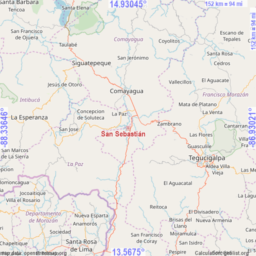
San Sebastián GPS coordinates[2]
14° 15' 0" North, 87° 37' 59.988" West
| Map corner | latitude | longitude |
|---|---|---|
| Upper-left | 14.93045°, | -88.33646° |
| Center: | 14.25°, | -87.63333° |
| Lower-right: | 13.5675°, | -86.93021° |
| Map W x H: | 151.5×151.5 km | = 94.1×94.1mi |
| max Lat: | 16.45° ⇑79.8% North |
| San Sebastián: | 14.25° |
| min Lat: | ⇓20.2% South 13.11667° |
| min Long | San Sebastián | max Long |
| -89.23333° | -87.63333° | -83.23333° |
| W 49.8%⇐ | ⇒50.2% E |
Elevation
Elevation of San Sebastián is 649 m = 2129 ft, and this is 87.8 m = 288 ft above average elevation for this country.
| Max E: |
1811 m = 5942 ft | 42.8% |
| San Sebastián | 649 m 2129 ft | |
| Avg. | 561.2 m = 1841 ft | |
Min E: |
1 m = 3 ft | 57.2% |
See also: Honduras elevation on elevation.city.
Geographical zone
San Sebastián is located in North Torrid zone (between Equator and Tropic of Cancer). Distance of this Northern Tropic circle is 1021.5 km =634.7 mi to North.| Distance of | km | miles | from San Sebastián |
|---|---|---|---|
| North Pole | 8422.6 | 5233.6 | to North |
| Arctic Circle | 5816.7 | 3614.3 | to North |
| Tropic Cancer | 1021.5 | 634.7 | to North |
| Equator | 1584.5 | 984.6 | to South |


Nearby cities:
15 places around San Sebastián: (largest is in red/bold)
• Ajuterique
16.5 km =10.3 mi,  334°
334°
• Cane
5.2 km =3.2 mi,  315°
315°
• Comayagua
22.4 km =13.9 mi,  358°
358°
• Flores
8.1 km =5 mi,  62°
62°
• La Paz
9.2 km =5.7 mi, 327°
• Lamaní
5.8 km =3.6 mi,  162°
162°
• Las Mercedes
8.1 km =5 mi, 62°
• Lejamaní
14.8 km =9.2 mi, 331°
• Lepaterique
27.2 km =16.9 mi,  138°
138°
• San Pedro de Tutule
23.4 km =14.5 mi,  270°
270°
• Tepanguare
15.6 km =9.7 mi,  306°
306°
• Valle de Ángeles
27.8 km =17.3 mi,  0°
0°
• Villa de San Antonio
7.6 km =4.7 mi,  13°
13°
• Yarumela
9.3 km =5.8 mi, 0°
• Zambrano
25.2 km =15.7 mi,  85°
85°
Sources, notices
• [Note1] Compared only with cities in Honduras existing in our database
• [Src1] Map data: © OpenStreetMap contributors (CC-BY-SA)
• [Src2] Other city data from geonames.org with taken over terms of usage.
• [Src3] Geographical zone / Annual Mean Temperature by Robert A. Rohde @ Wikipedia
