Erandique geodata
Erandique (Lempira) is a populated place; located in Honduras in America/Tegucigalpa (GMT-6) time zone. With population of 1,882 people, there are 194 cities with bigger population in this country. Compared to other cities in Honduras, 80% of cities are located further ↑North; 81.6% of cities are located further →East and 94% of cities have lower elevation than Erandique. Note1


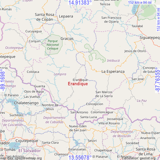
Erandique GPS coordinates[2]
14° 13' 59.988" North, 88° 28' 0.012" West
| Map corner | latitude | longitude |
|---|---|---|
| Upper-left | 14.91383°, | -89.1698° |
| Center: | 14.23333°, | -88.46667° |
| Lower-right: | 13.55078°, | -87.76355° |
| Map W x H: | 151.6×151.6 km | = 94.2×94.2mi |
| max Lat: | 16.45° ⇑80% North |
| Erandique: | 14.23333° |
| min Lat: | ⇓20% South 13.11667° |
| min Long | Erandique | max Long |
| -89.23333° | -88.46667° | -83.23333° |
| W 18.4%⇐ | ⇒81.6% E |
Elevation
Elevation of Erandique is 1266 m = 4154 ft, and this is 704.8 m = 2312 ft above average elevation for this country.
| Max E: |
1811 m = 5942 ft | 6% |
| Erandique | 1266 m 4154 ft | |
| Avg. | 561.2 m = 1841 ft | |
Min E: |
1 m = 3 ft | 94% |
See also: Honduras elevation on elevation.city.
Geographical zone
Erandique is located in North Torrid zone (between Equator and Tropic of Cancer). Distance of this Northern Tropic circle is 1023.3 km =635.8 mi to North.| Distance of | km | miles | from Erandique |
|---|---|---|---|
| North Pole | 8424.5 | 5234.7 | to North |
| Arctic Circle | 5818.6 | 3615.5 | to North |
| Tropic Cancer | 1023.3 | 635.8 | to North |
| Equator | 1582.6 | 983.4 | to South |


Nearby cities:
15 places around Erandique: (largest is in red/bold)
• Azacualpa
9.7 km =6 mi,  67°
67°
• Belén Gualcho
45.4 km =28.2 mi,  307°
307°
• Camasca
27.5 km =17.1 mi,  160°
160°
• Cololaca
45.5 km =28.3 mi,  279°
279°
• El Achiotal
34.8 km =21.6 mi,  241°
241°
• El Granzal
46.9 km =29.1 mi,  293°
293°
• Gracias
41.6 km =25.8 mi,  342°
342°
• Guatemalita
20.7 km =12.9 mi,  231°
231°
• Intibucá
33.6 km =20.9 mi, 74°
• Jiquinlaca
28.8 km =17.9 mi,  154°
154°
• La Esperanza
32 km =19.9 mi, 74°
• La Virtud
32.4 km =20.1 mi, 230°
• Lagunas
42.7 km =26.5 mi,  357°
357°
• Magdalena
44.6 km =27.7 mi, 156°
• Yamaranguila
24 km =14.9 mi,  76°
76°
Sources, notices
• [Note1] Compared only with cities in Honduras existing in our database
• [Src1] Map data: © OpenStreetMap contributors (CC-BY-SA)
• [Src2] Other city data from geonames.org with taken over terms of usage.
• [Src3] Geographical zone / Annual Mean Temperature by Robert A. Rohde @ Wikipedia
