Zlatar geodata
Zlatar (Krapinsko-Zagorska) is a seat of a second-order administrative division; located in Croatia in Europe/Zagreb (GMT+2) time zone. With population of 2,903 people, there are 144 cities with bigger population in this country. Compared to other cities in Croatia, 84.7% of cities are located further ↓South; 66.7% of cities are located further →East and 75.4% of cities have lower elevation than Zlatar. Note1


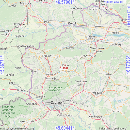
Zlatar GPS coordinates[2]
46° 5' 39.012" North, 16° 4' 14.988" East
| Map corner | latitude | longitude |
|---|---|---|
| Upper-left | 46.57961°, | 15.36771° |
| Center: | 46.09417°, | 16.07083° |
| Lower-right: | 45.60441°, | 16.77396° |
| Map W x H: | 108.4×108.4 km | = 67.4×67.4mi |
| max Lat: | 46.52694° ⇑15.3% North |
| Zlatar: | 46.09417° |
| min Lat: | ⇓84.7% South 42.54972° |
| min Long | Zlatar | max Long |
| 13.52389° | 16.07083° | 19.37694° |
| W 33.3%⇐ | ⇒66.7% E |
Elevation
Elevation of Zlatar is 180 m = 591 ft, and this is 26.7 m = 88 ft above average elevation for this country.
| Max E: |
827 m = 2713 ft | 24.6% |
| Zlatar | 180 m 591 ft | |
| Avg. | 153.3 m = 503 ft | |
Min E: |
-1 m = -3 ft | 75.4% |
See also: Croatia elevation on elevation.city.
Geographical zone
Zlatar is located in North temperate zone (between Tropic of Cancer and the Arctic Circle). Distance of this North polar circle is 2276 km =1414.2 mi to North.| Distance of | km | miles | from Zlatar |
|---|---|---|---|
| North Pole | 4881.9 | 3033.5 | to North |
| Arctic Circle | 2276 | 1414.2 | to North |
| Tropic Cancer | 2519.3 | 1565.4 | to South |
| Equator | 5125.2 | 3184.7 | to South |


Nearby cities:
15 places around Zlatar: (largest is in red/bold)
• Bedekovčina
8.2 km =5.1 mi,  224°
224°
• Budinšćina
11.1 km =6.9 mi,  69°
69°
• Hrašćina
12.2 km =7.6 mi,  80°
80°
• Hum Stubički
9.8 km =6.1 mi,  171°
171°
• Jertovec
10.8 km =6.7 mi,  123°
123°
• Konjšćina
9.1 km =5.7 mi, 120°
• Lobor
6.1 km =3.8 mi,  351°
351°
• Lobor
6.5 km =4 mi,  357°
357°
• Marija Bistrica
10.3 km =6.4 mi,  162°
162°
• Mače
2.7 km =1.7 mi,  271°
271°
• Mihovljan
8.7 km =5.4 mi,  299°
299°
• Novi Golubovec
11.1 km =6.9 mi,  321°
321°
• Poznanovec
5.8 km =3.6 mi,  214°
214°
• Selnica
7.8 km =4.8 mi,  194°
194°
• Tugonica
7.6 km =4.7 mi, 161°
Sources, notices
• [Note1] Compared only with cities in Croatia existing in our database
• [Src1] Map data: © OpenStreetMap contributors (CC-BY-SA)
• [Src2] Other city data from geonames.org with taken over terms of usage.
• [Src3] Geographical zone / Annual Mean Temperature by Robert A. Rohde @ Wikipedia
