Veli Lošinj geodata
Veli Lošinj (Primorsko-Goranska) is a populated place; located in Croatia in Europe/Zagreb (GMT+2) time zone. With population of 901 people, there are 524 cities with bigger population in this country. Compared to other cities in Croatia, 79.4% of cities are located further ↑North; 93% of cities are located further →East and 89.6% of cities have higher elevation than Veli Lošinj. Note1


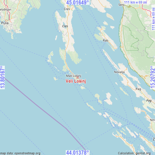
Veli Lošinj GPS coordinates[2]
44° 31' 2.244" North, 14° 30' 17.244" East
| Map corner | latitude | longitude |
|---|---|---|
| Upper-left | 45.01649°, | 13.80167° |
| Center: | 44.51729°, | 14.50479° |
| Lower-right: | 44.01378°, | 15.20792° |
| Map W x H: | 111.5×111.5 km | = 69.3×69.3mi |
| max Lat: | 46.52694° ⇑79.4% North |
| Veli Lošinj: | 44.51729° |
| min Lat: | ⇓20.6% South 42.54972° |
| min Long | Veli Lošinj | max Long |
| 13.52389° | 14.50479° | 19.37694° |
| W 7%⇐ | ⇒93% E |
Elevation
Elevation of Veli Lošinj is 23 m = 75 ft, and this is 130.3 m = 427 ft below average elevation for this country.
| Max E: |
827 m = 2713 ft | 89.6% |
| Avg. | 153.3 m = 503 ft | |
| Veli Lošinj | 23 m = 75 ft | |
Min E: |
-1 m = -3 ft | 10.4% |
See also: Croatia elevation on elevation.city.
Geographical zone
Veli Lošinj is located in North temperate zone (between Tropic of Cancer and the Arctic Circle). Distance of this Northern Tropic circle is 2343.9 km =1456.4 mi to South.| Distance of | km | miles | from Veli Lošinj |
|---|---|---|---|
| North Pole | 5057.2 | 3142.4 | to North |
| Arctic Circle | 2451.3 | 1523.2 | to North |
| Tropic Cancer | 2343.9 | 1456.4 | to South |
| Equator | 4949.9 | 3075.7 | to South |


Nearby cities:
15 places around Veli Lošinj: (largest is in red/bold)
• Banjol
34 km =21.1 mi,  40°
40°
• Cres
49.9 km =31 mi,  351°
351°
• Kampor
33.3 km =20.7 mi,  30°
30°
• Karlobag
45.1 km =28 mi,  88°
88°
• Kolan
36.3 km =22.6 mi, 94°
• Lopar
39.3 km =24.4 mi, 26°
• Mali Lošinj
3.2 km =2 mi,  297°
297°
• Mundanije
34.8 km =21.6 mi, 35°
• Novalja
30.6 km =19 mi,  81°
81°
• Pag
44.6 km =27.7 mi,  100°
100°
• Povljana
52.1 km =32.4 mi,  111°
111°
• Rab
33.5 km =20.8 mi, 37°
• Stari Grad
45.3 km =28.1 mi, 102°
• Supetarska Draga
35.7 km =22.2 mi, 29°
• Vir
51.9 km =32.2 mi,  117°
117°
Sources, notices
• [Note1] Compared only with cities in Croatia existing in our database
• [Src1] Map data: © OpenStreetMap contributors (CC-BY-SA)
• [Src2] Other city data from geonames.org with taken over terms of usage.
• [Src3] Geographical zone / Annual Mean Temperature by Robert A. Rohde @ Wikipedia
