Novalja geodata
Novalja (Ličko-Senjska) is a seat of a second-order administrative division; located in Croatia in Europe/Zagreb (GMT+2) time zone. With population of 2,088 people, there are 201 cities with bigger population in this country. Compared to other cities in Croatia, 78.9% of cities are located further ↑North; 89.5% of cities are located further →East and 91.5% of cities have higher elevation than Novalja. Note1


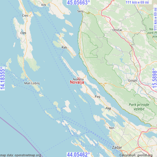
Novalja GPS coordinates[2]
44° 33' 28.008" North, 14° 53' 12.012" East
| Map corner | latitude | longitude |
|---|---|---|
| Upper-left | 45.05663°, | 14.18355° |
| Center: | 44.55778°, | 14.88667° |
| Lower-right: | 44.05462°, | 15.5898° |
| Map W x H: | 111.4×111.4 km | = 69.2×69.2mi |
| max Lat: | 46.52694° ⇑78.9% North |
| Novalja: | 44.55778° |
| min Lat: | ⇓21.1% South 42.54972° |
| min Long | Novalja | max Long |
| 13.52389° | 14.88667° | 19.37694° |
| W 10.5%⇐ | ⇒89.5% E |
Elevation
Elevation of Novalja is 17 m = 56 ft, and this is 136.3 m = 447 ft below average elevation for this country.
| Max E: |
827 m = 2713 ft | 91.5% |
| Avg. | 153.3 m = 503 ft | |
| Novalja | 17 m = 56 ft | |
Min E: |
-1 m = -3 ft | 8.5% |
See also: Croatia elevation on elevation.city.
Geographical zone
Novalja is located in North temperate zone (between Tropic of Cancer and the Arctic Circle). Distance of this Northern Tropic circle is 2348.4 km =1459.2 mi to South.| Distance of | km | miles | from Novalja |
|---|---|---|---|
| North Pole | 5052.7 | 3139.6 | to North |
| Arctic Circle | 2446.8 | 1520.4 | to North |
| Tropic Cancer | 2348.4 | 1459.2 | to South |
| Equator | 4954.4 | 3078.5 | to South |


Nearby cities:
15 places around Novalja: (largest is in red/bold)
• Banjol
22.9 km =14.2 mi,  339°
339°
• Kampor
27.6 km =17.1 mi,  331°
331°
• Karlobag
15.2 km =9.4 mi,  102°
102°
• Kolan
9.2 km =5.7 mi,  140°
140°
• Lopar
33 km =20.5 mi, 337°
• Mali Lošinj
33.3 km =20.7 mi,  264°
264°
• Mundanije
25.7 km =16 mi, 337°
• Pag
18.5 km =11.5 mi,  132°
132°
• Popovača
24.9 km =15.5 mi,  68°
68°
• Povljana
29.7 km =18.5 mi, 142°
• Rab
24.3 km =15.1 mi, 335°
• Stari Grad
19.9 km =12.4 mi, 135°
• Supetarska Draga
29.6 km =18.4 mi, 334°
• Veli Lošinj
30.6 km =19 mi, 261°
• Vir
32.4 km =20.1 mi,  150°
150°
Sources, notices
• [Note1] Compared only with cities in Croatia existing in our database
• [Src1] Map data: © OpenStreetMap contributors (CC-BY-SA)
• [Src2] Other city data from geonames.org with taken over terms of usage.
• [Src3] Geographical zone / Annual Mean Temperature by Robert A. Rohde @ Wikipedia
