Perušić geodata
Perušić (Ličko-Senjska) is a seat of a second-order administrative division; located in Croatia in Europe/Zagreb (GMT+2) time zone. With population of 962 people, there are 479 cities with bigger population in this country. Compared to other cities in Croatia, 78.6% of cities are located further ↑North; 84.5% of cities are located further →East and 98.4% of cities have lower elevation than Perušić. Note1


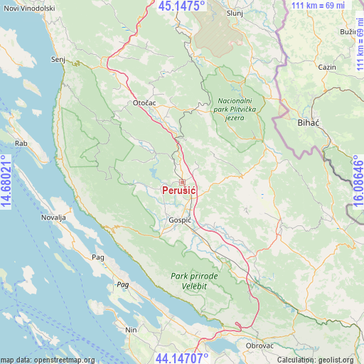
Perušić GPS coordinates[2]
44° 38' 57.984" North, 15° 22' 59.988" East
| Map corner | latitude | longitude |
|---|---|---|
| Upper-left | 45.1475°, | 14.68021° |
| Center: | 44.64944°, | 15.38333° |
| Lower-right: | 44.14707°, | 16.08646° |
| Map W x H: | 111.2×111.2 km | = 69.1×69.1mi |
| max Lat: | 46.52694° ⇑78.6% North |
| Perušić: | 44.64944° |
| min Lat: | ⇓21.4% South 42.54972° |
| min Long | Perušić | max Long |
| 13.52389° | 15.38333° | 19.37694° |
| W 15.5%⇐ | ⇒84.5% E |
Elevation
Elevation of Perušić is 579 m = 1900 ft, and this is 425.7 m = 1397 ft above average elevation for this country.
| Max E: |
827 m = 2713 ft | 1.6% |
| Perušić | 579 m 1900 ft | |
| Avg. | 153.3 m = 503 ft | |
Min E: |
-1 m = -3 ft | 98.4% |
See also: Croatia elevation on elevation.city.
Geographical zone
Perušić is located in North temperate zone (between Tropic of Cancer and the Arctic Circle). Distance of this Northern Tropic circle is 2358.6 km =1465.6 mi to South.| Distance of | km | miles | from Perušić |
|---|---|---|---|
| North Pole | 5042.5 | 3133.3 | to North |
| Arctic Circle | 2436.6 | 1514 | to North |
| Tropic Cancer | 2358.6 | 1465.6 | to South |
| Equator | 4964.6 | 3084.9 | to South |


Nearby cities:
15 places around Perušić: (largest is in red/bold)
• Gornji Prozor
23.3 km =14.5 mi,  337°
337°
• Gospić
11.5 km =7.1 mi,  183°
183°
• Karlobag
28 km =17.4 mi,  241°
241°
• Korenica
27.9 km =17.3 mi,  67°
67°
• Kuterevo
27.4 km =17 mi,  315°
315°
• Lički Osik
6 km =3.7 mi,  147°
147°
• Ličko Lešće
17.9 km =11.1 mi, 344°
• Otočac
27 km =16.8 mi,  334°
334°
• Pag
34.4 km =21.4 mi,  228°
228°
• Popovača
16.2 km =10.1 mi,  265°
265°
• Sinac
20.4 km =12.7 mi,  348°
348°
• Stari Grad
35.3 km =21.9 mi, 226°
• Udbina
33 km =20.5 mi,  113°
113°
• Vrhovine
22.7 km =14.1 mi,  7°
7°
• Čovići
20.9 km =13 mi, 341°
Sources, notices
• [Note1] Compared only with cities in Croatia existing in our database
• [Src1] Map data: © OpenStreetMap contributors (CC-BY-SA)
• [Src2] Other city data from geonames.org with taken over terms of usage.
• [Src3] Geographical zone / Annual Mean Temperature by Robert A. Rohde @ Wikipedia
