Haganj geodata
Haganj (Zagrebačka) is a populated place; located in Croatia in Europe/Zagreb (GMT+2) time zone. With population of 504 people, there are 881 cities with bigger population in this country. Compared to other cities in Croatia, 78.1% of cities are located further ↓South; 55.2% of cities are located further ←West and 65.3% of cities have lower elevation than Haganj. Note1


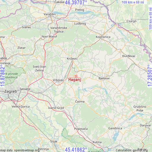
Haganj GPS coordinates[2]
45° 54' 36" North, 16° 34' 54.984" East
| Map corner | latitude | longitude |
|---|---|---|
| Upper-left | 46.39707°, | 15.87882° |
| Center: | 45.91°, | 16.58194° |
| Lower-right: | 45.41862°, | 17.28507° |
| Map W x H: | 108.8×108.8 km | = 67.6×67.6mi |
| max Lat: | 46.52694° ⇑21.9% North |
| Haganj: | 45.91° |
| min Lat: | ⇓78.1% South 42.54972° |
| min Long | Haganj | max Long |
| 13.52389° | 16.58194° | 19.37694° |
| W 55.2%⇐ | ⇒44.8% E |
Elevation
Elevation of Haganj is 155 m = 509 ft, and this is 1.7 m = 6 ft above average elevation for this country.
| Max E: |
827 m = 2713 ft | 34.7% |
| Haganj | 155 m 509 ft | |
| Avg. | 153.3 m = 503 ft | |
Min E: |
-1 m = -3 ft | 65.3% |
See also: Croatia elevation on elevation.city.
Geographical zone
Haganj is located in North temperate zone (between Tropic of Cancer and the Arctic Circle). Distance of this North polar circle is 2296.5 km =1427 mi to North.| Distance of | km | miles | from Haganj |
|---|---|---|---|
| North Pole | 4902.3 | 3046.1 | to North |
| Arctic Circle | 2296.5 | 1427 | to North |
| Tropic Cancer | 2498.8 | 1552.7 | to South |
| Equator | 5104.7 | 3171.9 | to South |


Nearby cities:
15 places around Haganj: (largest is in red/bold)
• Brčevec
13.7 km =8.5 mi,  249°
249°
• Cirkvena
6.6 km =4.1 mi,  68°
68°
• Cubinec
8.2 km =5.1 mi,  351°
351°
• Dubrava
8.7 km =5.4 mi,  203°
203°
• Farkaševac
5.7 km =3.5 mi,  126°
126°
• Gradec
7.7 km =4.8 mi,  270°
270°
• Klokočevac
15.6 km =9.7 mi,  87°
87°
• Križevci
12.8 km =8 mi, 346°
• Pavlovec Gradečki
7.7 km =4.8 mi,  261°
261°
• Prgomelje
13.3 km =8.3 mi,  99°
99°
• Rovišće
12.5 km =7.8 mi, 71°
• Sveti Ivan Žabno
4.7 km =2.9 mi,  31°
31°
• Sveti Petar Čvrstec
12.1 km =7.5 mi, 31°
• Trema
8.4 km =5.2 mi,  9°
9°
• Vrbovec
12.8 km =8 mi, 256°
Sources, notices
• [Note1] Compared only with cities in Croatia existing in our database
• [Src1] Map data: © OpenStreetMap contributors (CC-BY-SA)
• [Src2] Other city data from geonames.org with taken over terms of usage.
• [Src3] Geographical zone / Annual Mean Temperature by Robert A. Rohde @ Wikipedia
