Thiotte geodata
Thiotte (Sud-Est) is a populated place; located in Haiti in America/Port-au-Prince (GMT-4) time zone. With population of 2,461 people, there are 67 cities with bigger population in this country. Compared to other cities in Haiti, 88.7% of cities are located further ↑North; 91.5% of cities are located further ←West and 98.1% of cities have lower elevation than Thiotte. Note1


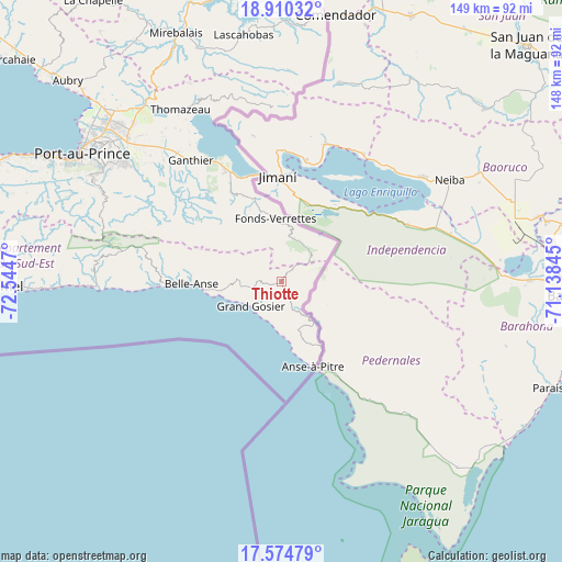
Thiotte GPS coordinates[2]
18° 14' 37.824" North, 71° 50' 29.652" West
| Map corner | latitude | longitude |
|---|---|---|
| Upper-left | 18.91032°, | -72.5447° |
| Center: | 18.24384°, | -71.84157° |
| Lower-right: | 17.57479°, | -71.13845° |
| Map W x H: | 148.5×148.5 km | = 92.3×92.3mi |
| max Lat: | 19.93984° ⇑88.7% North |
| Thiotte: | 18.24384° |
| min Lat: | ⇓11.3% South 18.05° |
| min Long | Thiotte | max Long |
| -74.4528° | -71.84157° | -71.72475° |
| W 91.5%⇐ | ⇒8.5% E |
Elevation
Elevation of Thiotte is 907 m = 2976 ft, and this is 761.9 m = 2500 ft above average elevation for this country.
| Max E: |
1466 m = 4810 ft | 1.9% |
| Thiotte | 907 m 2976 ft | |
| Avg. | 145.1 m = 476 ft | |
Min E: |
3 m = 10 ft | 98.1% |
See also: Haiti elevation on elevation.city.
Geographical zone
Thiotte is located in North Torrid zone (between Equator and Tropic of Cancer). Distance of this Northern Tropic circle is 577.4 km =358.8 mi to North.| Distance of | km | miles | from Thiotte |
|---|---|---|---|
| North Pole | 7978.5 | 4957.6 | to North |
| Arctic Circle | 5372.6 | 3338.4 | to North |
| Tropic Cancer | 577.4 | 358.8 | to North |
| Equator | 2028.5 | 1260.5 | to South |


Nearby cities:
15 places around Thiotte: (largest is in red/bold)
• Anse-à-Pitre
23.6 km =14.7 mi,  155°
155°
• Belle-Anse
23.8 km =14.8 mi,  268°
268°
• Carrefour
67.5 km =41.9 mi,  299°
299°
• Cayes-Jacmel
58.5 km =36.4 mi, 268°
• Cornillon
49.4 km =30.7 mi,  346°
346°
• Croix-des-Bouquets
54.9 km =34.1 mi,  312°
312°
• Delmas 73
59.1 km =36.7 mi, 304°
• Fond Parisien
32.6 km =20.3 mi,  333°
333°
• Fonds Verrettes
17 km =10.6 mi, 354°
• Kenscoff
51.9 km =32.2 mi, 295°
• Lascahobas
66 km =41 mi, 351°
• Marigot
50.8 km =31.6 mi, 268°
• Port-au-Prince
62.1 km =38.6 mi, 302°
• Pétionville
55.5 km =34.5 mi, 302°
• Thomazeau
52.7 km =32.7 mi, 329°
Sources, notices
• [Note1] Compared only with cities in Haiti existing in our database
• [Src1] Map data: © OpenStreetMap contributors (CC-BY-SA)
• [Src2] Other city data from geonames.org with taken over terms of usage.
• [Src3] Geographical zone / Annual Mean Temperature by Robert A. Rohde @ Wikipedia
