Belle-Anse geodata
Belle-Anse (Sud-Est) is a populated place; located in Haiti in America/Port-au-Prince (GMT-4) time zone. With population of 2,611 people, there are 65 cities with bigger population in this country. Compared to other cities in Haiti, 89.6% of cities are located further ↑North; 80.2% of cities are located further ←West and 90.6% of cities have higher elevation than Belle-Anse. Note1


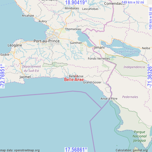
Belle-Anse GPS coordinates[2]
18° 14' 15.648" North, 72° 3' 58.968" West
| Map corner | latitude | longitude |
|---|---|---|
| Upper-left | 18.90419°, | -72.76951° |
| Center: | 18.23768°, | -72.06638° |
| Lower-right: | 17.56861°, | -71.36326° |
| Map W x H: | 148.5×148.5 km | = 92.3×92.3mi |
| max Lat: | 19.93984° ⇑89.6% North |
| Belle-Anse: | 18.23768° |
| min Lat: | ⇓10.4% South 18.05° |
| min Long | Belle-Anse | max Long |
| -74.4528° | -72.06638° | -71.72475° |
| W 80.2%⇐ | ⇒19.8% E |
Elevation
Elevation of Belle-Anse is 9 m = 30 ft, and this is 136.1 m = 447 ft below average elevation for this country.
| Max E: |
1466 m = 4810 ft | 90.6% |
| Avg. | 145.1 m = 476 ft | |
| Belle-Anse | 9 m = 30 ft | |
Min E: |
3 m = 10 ft | 9.4% |
See also: Haiti elevation on elevation.city.
Geographical zone
Belle-Anse is located in North Torrid zone (between Equator and Tropic of Cancer). Distance of this Northern Tropic circle is 578.1 km =359.2 mi to North.| Distance of | km | miles | from Belle-Anse |
|---|---|---|---|
| North Pole | 7979.2 | 4958 | to North |
| Arctic Circle | 5373.3 | 3338.8 | to North |
| Tropic Cancer | 578.1 | 359.2 | to North |
| Equator | 2027.8 | 1260 | to South |


Nearby cities:
15 places around Belle-Anse: (largest is in red/bold)
• Anse-à-Pitre
39.4 km =24.5 mi,  121°
121°
• Carrefour
48.7 km =30.3 mi,  313°
313°
• Cayes-Jacmel
34.8 km =21.6 mi,  268°
268°
• Cornillon
50.1 km =31.1 mi,  13°
13°
• Croix-des-Bouquets
41.3 km =25.7 mi,  335°
335°
• Delmas 73
42.3 km =26.3 mi,  323°
323°
• Fond Parisien
31.1 km =19.3 mi,  16°
16°
• Fonds Verrettes
28.3 km =17.6 mi,  51°
51°
• Jacmel
49.5 km =30.8 mi, 269°
• Kenscoff
32.8 km =20.4 mi, 315°
• Marigot
27.1 km =16.8 mi, 268°
• Port-au-Prince
44.5 km =27.7 mi, 319°
• Pétionville
38.3 km =23.8 mi, 322°
• Thiotte
23.8 km =14.8 mi,  88°
88°
• Thomazeau
46.3 km =28.8 mi,  356°
356°
Sources, notices
• [Note1] Compared only with cities in Haiti existing in our database
• [Src1] Map data: © OpenStreetMap contributors (CC-BY-SA)
• [Src2] Other city data from geonames.org with taken over terms of usage.
• [Src3] Geographical zone / Annual Mean Temperature by Robert A. Rohde @ Wikipedia
