Pannonhalma geodata
Pannonhalma (Győr-Moson-Sopron) is a seat of a second-order administrative division; located in Hungary in Europe/Budapest (GMT+2) time zone. With population of 4,089 people, there are 369 cities with bigger population in this country. Compared to other cities in Hungary, 59.3% of cities are located further ↓South; 88.7% of cities are located further →East and 84.3% of cities have lower elevation than Pannonhalma. Note1


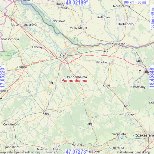
Pannonhalma GPS coordinates[2]
47° 32' 58.056" North, 17° 45' 19.26" East
| Map corner | latitude | longitude |
|---|---|---|
| Upper-left | 48.02189°, | 17.05223° |
| Center: | 47.54946°, | 17.75535° |
| Lower-right: | 47.07273°, | 18.45848° |
| Map W x H: | 105.5×105.5 km | = 65.6×65.6mi |
| max Lat: | 48.46667° ⇑40.7% North |
| Pannonhalma: | 47.54946° |
| min Lat: | ⇓59.3% South 45.79108° |
| min Long | Pannonhalma | max Long |
| 16.27358° | 17.75535° | 22.68096° |
| W 11.3%⇐ | ⇒88.7% E |
Elevation
Elevation of Pannonhalma is 170 m = 558 ft, and this is 40.3 m = 132 ft above average elevation for this country.
| Max E: |
444 m = 1457 ft | 15.7% |
| Pannonhalma | 170 m 558 ft | |
| Avg. | 129.7 m = 426 ft | |
Min E: |
71 m = 233 ft | 84.3% |
See also: Hungary elevation on elevation.city.
Geographical zone
Pannonhalma is located in North temperate zone (between Tropic of Cancer and the Arctic Circle). Distance of this North polar circle is 2114.2 km =1313.7 mi to North.| Distance of | km | miles | from Pannonhalma |
|---|---|---|---|
| North Pole | 4720.1 | 2932.9 | to North |
| Arctic Circle | 2114.2 | 1313.7 | to North |
| Tropic Cancer | 2681.1 | 1666 | to South |
| Equator | 5287 | 3285.2 | to South |


Nearby cities:
15 places around Pannonhalma: (largest is in red/bold)
• Abda
22.6 km =14 mi,  315°
315°
• Bakonyszentlászló
18.2 km =11.3 mi,  168°
168°
• Bábolna
19.7 km =12.2 mi,  57°
57°
• Bőny
14.1 km =8.8 mi,  37°
37°
• Ete
24.1 km =15 mi,  94°
94°
• Győr
17.4 km =10.8 mi,  328°
328°
• Győrszemere
14.4 km =8.9 mi,  271°
271°
• Győrújbarát
10.2 km =6.3 mi,  308°
308°
• Kisbér
21.7 km =13.5 mi,  103°
103°
• Nyúl
6.7 km =4.2 mi, 312°
• Pér
7.9 km =4.9 mi,  28°
28°
• Rábapatona
22.6 km =14 mi,  294°
294°
• Rábaszentmihály
24.4 km =15.2 mi,  277°
277°
• Tét
18.9 km =11.7 mi,  259°
259°
• Töltéstava
8.7 km =5.4 mi,  349°
349°
Sources, notices
• [Note1] Compared only with cities in Hungary existing in our database
• [Src1] Map data: © OpenStreetMap contributors (CC-BY-SA)
• [Src2] Other city data from geonames.org with taken over terms of usage.
• [Src3] Geographical zone / Annual Mean Temperature by Robert A. Rohde @ Wikipedia
