Ete geodata
Ete (Komárom-Esztergom) is a populated place; located in Hungary in Europe/Budapest (GMT+2) time zone. With population of 593 people, there are 889 cities with bigger population in this country. Compared to other cities in Hungary, 58.1% of cities are located further ↓South; 84.9% of cities are located further →East and 87.7% of cities have lower elevation than Ete. Note1


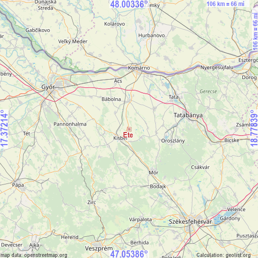
Ete GPS coordinates[2]
47° 31' 50.736" North, 18° 4' 30.936" East
| Map corner | latitude | longitude |
|---|---|---|
| Upper-left | 48.00336°, | 17.37214° |
| Center: | 47.53076°, | 18.07526° |
| Lower-right: | 47.05386°, | 18.77839° |
| Map W x H: | 105.6×105.6 km | = 65.6×65.6mi |
| max Lat: | 48.46667° ⇑41.9% North |
| Ete: | 47.53076° |
| min Lat: | ⇓58.1% South 45.79108° |
| min Long | Ete | max Long |
| 16.27358° | 18.07526° | 22.68096° |
| W 15.1%⇐ | ⇒84.9% E |
Elevation
Elevation of Ete is 180 m = 591 ft, and this is 50.3 m = 165 ft above average elevation for this country.
| Max E: |
444 m = 1457 ft | 12.3% |
| Ete | 180 m 591 ft | |
| Avg. | 129.7 m = 426 ft | |
Min E: |
71 m = 233 ft | 87.7% |
See also: Hungary elevation on elevation.city.
Geographical zone
Ete is located in North temperate zone (between Tropic of Cancer and the Arctic Circle). Distance of this North polar circle is 2116.2 km =1314.9 mi to North.| Distance of | km | miles | from Ete |
|---|---|---|---|
| North Pole | 4722.1 | 2934.2 | to North |
| Arctic Circle | 2116.2 | 1314.9 | to North |
| Tropic Cancer | 2679 | 1664.7 | to South |
| Equator | 5284.9 | 3283.9 | to South |


Nearby cities:
15 places around Ete: (largest is in red/bold)
• Bokod
13.6 km =8.5 mi,  108°
108°
• Bábolna
14.5 km =9 mi,  329°
329°
• Bőny
20.3 km =12.6 mi,  310°
310°
• Császár
6.2 km =3.9 mi,  125°
125°
• Kecskéd
17.6 km =10.9 mi,  92°
92°
• Kisbér
4.2 km =2.6 mi,  223°
223°
• Kocs
13.5 km =8.4 mi,  50°
50°
• Környe
18.5 km =11.5 mi,  84°
84°
• Mocsa
17.5 km =10.9 mi,  28°
28°
• Mór
19.5 km =12.1 mi,  150°
150°
• Nagyigmánd
12.3 km =7.6 mi,  2°
2°
• Oroszlány
18.5 km =11.5 mi, 105°
• Pusztavám
16 km =9.9 mi, 134°
• Pér
22.1 km =13.7 mi,  293°
293°
• Ács
20.7 km =12.9 mi,  346°
346°
Sources, notices
• [Note1] Compared only with cities in Hungary existing in our database
• [Src1] Map data: © OpenStreetMap contributors (CC-BY-SA)
• [Src2] Other city data from geonames.org with taken over terms of usage.
• [Src3] Geographical zone / Annual Mean Temperature by Robert A. Rohde @ Wikipedia
