Hercegszántó geodata
Hercegszántó (Bács-Kiskun) is a populated place; located in Hungary in Europe/Budapest (GMT+2) time zone. With population of 2,308 people, there are 669 cities with bigger population in this country. Compared to other cities in Hungary, 99.3% of cities are located further ↑North; 67% of cities are located further →East and 89.4% of cities have higher elevation than Hercegszántó. Note1


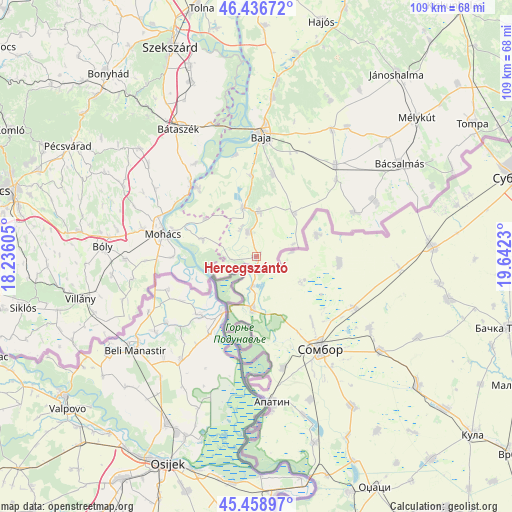
Hercegszántó GPS coordinates[2]
45° 57' 0" North, 18° 56' 21.012" East
| Map corner | latitude | longitude |
|---|---|---|
| Upper-left | 46.43672°, | 18.23605° |
| Center: | 45.95°, | 18.93917° |
| Lower-right: | 45.45897°, | 19.6423° |
| Map W x H: | 108.7×108.7 km | = 67.5×67.5mi |
| max Lat: | 48.46667° ⇑99.3% North |
| Hercegszántó: | 45.95° |
| min Lat: | ⇓0.7% South 45.79108° |
| min Long | Hercegszántó | max Long |
| 16.27358° | 18.93917° | 22.68096° |
| W 33%⇐ | ⇒67% E |
Elevation
Elevation of Hercegszántó is 87 m = 285 ft, and this is 42.7 m = 140 ft below average elevation for this country.
| Max E: |
444 m = 1457 ft | 89.4% |
| Avg. | 129.7 m = 426 ft | |
| Hercegszántó | 87 m = 285 ft | |
Min E: |
71 m = 233 ft | 10.6% |
See also: Hungary elevation on elevation.city.
Geographical zone
Hercegszántó is located in North temperate zone (between Tropic of Cancer and the Arctic Circle). Distance of this North polar circle is 2292 km =1424.2 mi to North.| Distance of | km | miles | from Hercegszántó |
|---|---|---|---|
| North Pole | 4897.9 | 3043.4 | to North |
| Arctic Circle | 2292 | 1424.2 | to North |
| Tropic Cancer | 2503.2 | 1555.4 | to South |
| Equator | 5109.2 | 3174.7 | to South |


Nearby cities:
15 places around Hercegszántó: (largest is in red/bold)
• Baja
25.9 km =16.1 mi,  2°
2°
• Bácsbokod
25.7 km =16 mi,  40°
40°
• Báta
23.8 km =14.8 mi,  326°
326°
• Bátaszék
31.8 km =19.8 mi, 328°
• Bóly
32.6 km =20.3 mi,  273°
273°
• Csávoly
31 km =19.3 mi,  31°
31°
• Dunaszekcső
20.7 km =12.9 mi,  317°
317°
• Dávod
5.3 km =3.3 mi,  341°
341°
• Gara
12.1 km =7.5 mi, 41°
• Katymár
22.9 km =14.2 mi,  65°
65°
• Lánycsók
25 km =15.5 mi,  284°
284°
• Madaras
27.7 km =17.2 mi,  64°
64°
• Mohács
20.1 km =12.5 mi, 282°
• Nagybaracska
10.6 km =6.6 mi,  345°
345°
• Vaskút
17.9 km =11.1 mi,  11°
11°
Sources, notices
• [Note1] Compared only with cities in Hungary existing in our database
• [Src1] Map data: © OpenStreetMap contributors (CC-BY-SA)
• [Src2] Other city data from geonames.org with taken over terms of usage.
• [Src3] Geographical zone / Annual Mean Temperature by Robert A. Rohde @ Wikipedia
