Madaras geodata
Madaras (Bács-Kiskun) is a populated place; located in Hungary in Europe/Budapest (GMT+2) time zone. With population of 3,246 people, there are 450 cities with bigger population in this country. Compared to other cities in Hungary, 97.7% of cities are located further ↑North; 55.4% of cities are located further →East and 50.7% of cities have lower elevation than Madaras. Note1


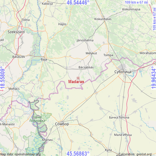
Madaras GPS coordinates[2]
46° 3' 31.32" North, 19° 15' 40.356" East
| Map corner | latitude | longitude |
|---|---|---|
| Upper-left | 46.54446°, | 18.55809° |
| Center: | 46.0587°, | 19.26121° |
| Lower-right: | 45.56863°, | 19.96434° |
| Map W x H: | 108.5×108.5 km | = 67.4×67.4mi |
| max Lat: | 48.46667° ⇑97.7% North |
| Madaras: | 46.0587° |
| min Lat: | ⇓2.3% South 45.79108° |
| min Long | Madaras | max Long |
| 16.27358° | 19.26121° | 22.68096° |
| W 44.6%⇐ | ⇒55.4% E |
Elevation
Elevation of Madaras is 116 m = 381 ft, and this is 13.7 m = 45 ft below average elevation for this country.
| Max E: |
444 m = 1457 ft | 49.3% |
| Avg. | 129.7 m = 426 ft | |
| Madaras | 116 m = 381 ft | |
Min E: |
71 m = 233 ft | 50.7% |
See also: Hungary elevation on elevation.city.
Geographical zone
Madaras is located in North temperate zone (between Tropic of Cancer and the Arctic Circle). Distance of this North polar circle is 2279.9 km =1416.7 mi to North.| Distance of | km | miles | from Madaras |
|---|---|---|---|
| North Pole | 4885.8 | 3035.9 | to North |
| Arctic Circle | 2279.9 | 1416.7 | to North |
| Tropic Cancer | 2515.3 | 1562.9 | to South |
| Equator | 5121.2 | 3182.2 | to South |


Nearby cities:
15 places around Madaras: (largest is in red/bold)
• Baja
27.5 km =17.1 mi,  300°
300°
• Bácsalmás
9.3 km =5.8 mi,  36°
36°
• Bácsbokod
10.9 km =6.8 mi,  312°
312°
• Csávoly
17 km =10.6 mi,  328°
328°
• Dávod
27.5 km =17.1 mi,  255°
255°
• Felsőszentiván
16.4 km =10.2 mi,  339°
339°
• Gara
17.1 km =10.6 mi, 259°
• Hercegszántó
27.7 km =17.2 mi,  244°
244°
• Jánoshalma
27.1 km =16.8 mi,  10°
10°
• Katymár
4.9 km =3 mi, 235°
• Kisszállás
30.3 km =18.8 mi, 35°
• Mélykút
19.7 km =12.2 mi,  27°
27°
• Nagybaracska
27.5 km =17.1 mi,  266°
266°
• Tompa
27 km =16.8 mi,  52°
52°
• Vaskút
22 km =13.7 mi,  284°
284°
Sources, notices
• [Note1] Compared only with cities in Hungary existing in our database
• [Src1] Map data: © OpenStreetMap contributors (CC-BY-SA)
• [Src2] Other city data from geonames.org with taken over terms of usage.
• [Src3] Geographical zone / Annual Mean Temperature by Robert A. Rohde @ Wikipedia
