Katymár geodata
Katymár (Bács-Kiskun) is a populated place; located in Hungary in Europe/Budapest (GMT+2) time zone. With population of 2,374 people, there are 645 cities with bigger population in this country. Compared to other cities in Hungary, 98.3% of cities are located further ↑North; 56.6% of cities are located further →East and 68.3% of cities have higher elevation than Katymár. Note1


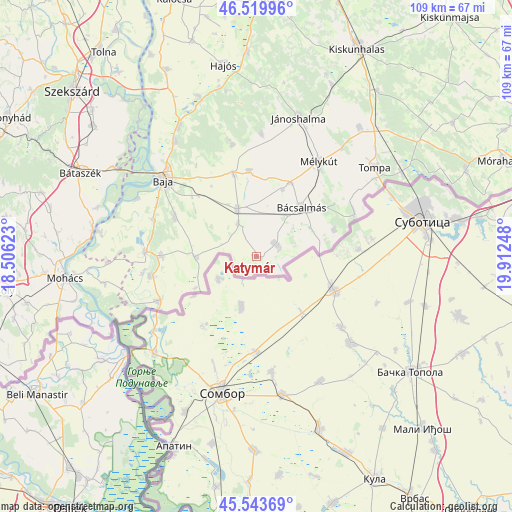
Katymár GPS coordinates[2]
46° 2' 2.328" North, 19° 12' 33.66" East
| Map corner | latitude | longitude |
|---|---|---|
| Upper-left | 46.51996°, | 18.50623° |
| Center: | 46.03398°, | 19.20935° |
| Lower-right: | 45.54369°, | 19.91248° |
| Map W x H: | 108.6×108.5 km | = 67.5×67.4mi |
| max Lat: | 48.46667° ⇑98.3% North |
| Katymár: | 46.03398° |
| min Lat: | ⇓1.7% South 45.79108° |
| min Long | Katymár | max Long |
| 16.27358° | 19.20935° | 22.68096° |
| W 43.4%⇐ | ⇒56.6% E |
Elevation
Elevation of Katymár is 103 m = 338 ft, and this is 26.7 m = 88 ft below average elevation for this country.
| Max E: |
444 m = 1457 ft | 68.3% |
| Avg. | 129.7 m = 426 ft | |
| Katymár | 103 m = 338 ft | |
Min E: |
71 m = 233 ft | 31.7% |
See also: Hungary elevation on elevation.city.
Geographical zone
Katymár is located in North temperate zone (between Tropic of Cancer and the Arctic Circle). Distance of this North polar circle is 2282.7 km =1418.4 mi to North.| Distance of | km | miles | from Katymár |
|---|---|---|---|
| North Pole | 4888.6 | 3037.6 | to North |
| Arctic Circle | 2282.7 | 1418.4 | to North |
| Tropic Cancer | 2512.6 | 1561.3 | to South |
| Equator | 5118.5 | 3180.5 | to South |


Nearby cities:
15 places around Katymár: (largest is in red/bold)
• Baja
25.8 km =16 mi,  309°
309°
• Bácsalmás
14 km =8.7 mi,  42°
42°
• Bácsbokod
10.9 km =6.8 mi,  337°
337°
• Csávoly
17.9 km =11.1 mi, 344°
• Dávod
23 km =14.3 mi,  259°
259°
• Felsőszentiván
18.2 km =11.3 mi,  354°
354°
• Gara
12.9 km =8 mi,  268°
268°
• Hercegszántó
22.9 km =14.2 mi,  245°
245°
• Jánoshalma
30.8 km =19.1 mi,  16°
16°
• Madaras
4.9 km =3 mi,  55°
55°
• Mélykút
24.1 km =15 mi,  33°
33°
• Nagybaracska
23.4 km =14.5 mi, 272°
• Tompa
31.8 km =19.8 mi,  53°
53°
• Vaskút
19.1 km =11.9 mi,  295°
295°
• Érsekcsanád
29.9 km =18.6 mi,  324°
324°
Sources, notices
• [Note1] Compared only with cities in Hungary existing in our database
• [Src1] Map data: © OpenStreetMap contributors (CC-BY-SA)
• [Src2] Other city data from geonames.org with taken over terms of usage.
• [Src3] Geographical zone / Annual Mean Temperature by Robert A. Rohde @ Wikipedia
