Ádánd geodata
Ádánd (Somogy) is a populated place; located in Hungary in Europe/Budapest (GMT+2) time zone. With population of 2,306 people, there are 670 cities with bigger population in this country. Compared to other cities in Hungary, 74.5% of cities are located further ↑North; 83.4% of cities are located further →East and 52.5% of cities have lower elevation than Ádánd. Note1


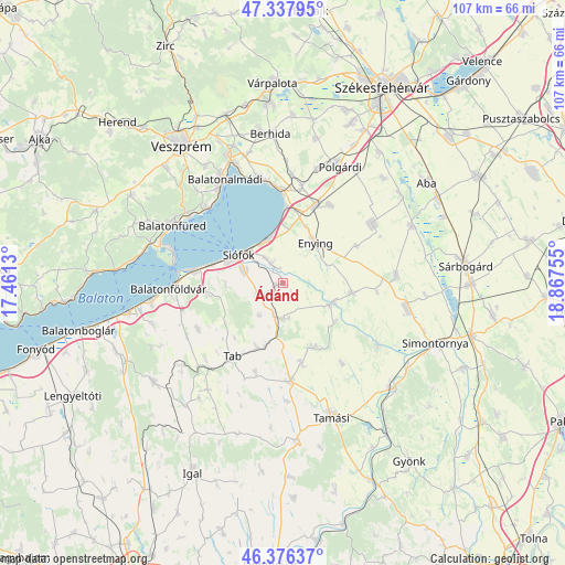
Ádánd GPS coordinates[2]
46° 51' 33.516" North, 18° 9' 51.912" East
| Map corner | latitude | longitude |
|---|---|---|
| Upper-left | 47.33795°, | 17.4613° |
| Center: | 46.85931°, | 18.16442° |
| Lower-right: | 46.37637°, | 18.86755° |
| Map W x H: | 106.9×106.9 km | = 66.4×66.4mi |
| max Lat: | 48.46667° ⇑74.5% North |
| Ádánd: | 46.85931° |
| min Lat: | ⇓25.5% South 45.79108° |
| min Long | Ádánd | max Long |
| 16.27358° | 18.16442° | 22.68096° |
| W 16.6%⇐ | ⇒83.4% E |
Elevation
Elevation of Ádánd is 118 m = 387 ft, and this is 11.7 m = 38 ft below average elevation for this country.
| Max E: |
444 m = 1457 ft | 47.5% |
| Avg. | 129.7 m = 426 ft | |
| Ádánd | 118 m = 387 ft | |
Min E: |
71 m = 233 ft | 52.5% |
See also: Hungary elevation on elevation.city.
Geographical zone
Ádánd is located in North temperate zone (between Tropic of Cancer and the Arctic Circle). Distance of this North polar circle is 2190.9 km =1361.4 mi to North.| Distance of | km | miles | from Ádánd |
|---|---|---|---|
| North Pole | 4796.8 | 2980.6 | to North |
| Arctic Circle | 2190.9 | 1361.4 | to North |
| Tropic Cancer | 2604.3 | 1618.2 | to South |
| Equator | 5210.3 | 3237.5 | to South |


Nearby cities:
15 places around Ádánd: (largest is in red/bold)
• Balatonalmádi
22.4 km =13.9 mi,  330°
330°
• Balatonföldvár
21.5 km =13.4 mi,  268°
268°
• Balatonkenese
20.6 km =12.8 mi,  347°
347°
• Balatonszabadi
4.4 km =2.7 mi, 331°
• Dég
21.8 km =13.5 mi,  87°
87°
• Enying
9.9 km =6.2 mi,  36°
36°
• Iregszemcse
18.6 km =11.6 mi,  174°
174°
• Kisláng
20.2 km =12.6 mi,  57°
57°
• Lajoskomárom
13.3 km =8.3 mi,  98°
98°
• Lepsény
15.8 km =9.8 mi,  22°
22°
• Ozora
21.6 km =13.4 mi,  123°
123°
• Siófok
9.5 km =5.9 mi,  301°
301°
• Tab
17.4 km =10.8 mi,  215°
215°
• Tihany
21.8 km =13.5 mi,  286°
286°
• Zamárdi
16.3 km =10.1 mi,  280°
280°
Sources, notices
• [Note1] Compared only with cities in Hungary existing in our database
• [Src1] Map data: © OpenStreetMap contributors (CC-BY-SA)
• [Src2] Other city data from geonames.org with taken over terms of usage.
• [Src3] Geographical zone / Annual Mean Temperature by Robert A. Rohde @ Wikipedia
