Lepsény geodata
Lepsény (Fejér) is a populated place; located in Hungary in Europe/Budapest (GMT+2) time zone. With population of 3,224 people, there are 454 cities with bigger population in this country. Compared to other cities in Hungary, 69.6% of cities are located further ↑North; 82% of cities are located further →East and 59.7% of cities have higher elevation than Lepsény. Note1


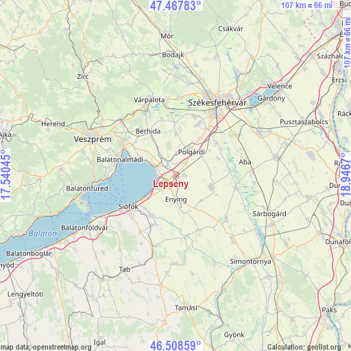
Lepsény GPS coordinates[2]
46° 59' 25.296" North, 18° 14' 36.852" East
| Map corner | latitude | longitude |
|---|---|---|
| Upper-left | 47.46783°, | 17.54045° |
| Center: | 46.99036°, | 18.24357° |
| Lower-right: | 46.50859°, | 18.9467° |
| Map W x H: | 106.7×106.7 km | = 66.3×66.3mi |
| max Lat: | 48.46667° ⇑69.6% North |
| Lepsény: | 46.99036° |
| min Lat: | ⇓30.4% South 45.79108° |
| min Long | Lepsény | max Long |
| 16.27358° | 18.24357° | 22.68096° |
| W 18%⇐ | ⇒82% E |
Elevation
Elevation of Lepsény is 110 m = 361 ft, and this is 19.7 m = 65 ft below average elevation for this country.
| Max E: |
444 m = 1457 ft | 59.7% |
| Avg. | 129.7 m = 426 ft | |
| Lepsény | 110 m = 361 ft | |
Min E: |
71 m = 233 ft | 40.3% |
See also: Hungary elevation on elevation.city.
Geographical zone
Lepsény is located in North temperate zone (between Tropic of Cancer and the Arctic Circle). Distance of this North polar circle is 2176.3 km =1352.3 mi to North.| Distance of | km | miles | from Lepsény |
|---|---|---|---|
| North Pole | 4782.2 | 2971.5 | to North |
| Arctic Circle | 2176.3 | 1352.3 | to North |
| Tropic Cancer | 2618.9 | 1627.3 | to South |
| Equator | 5224.8 | 3246.5 | to South |


Nearby cities:
15 places around Lepsény: (largest is in red/bold)
• Balatonalmádi
17.6 km =10.9 mi,  286°
286°
• Balatonkenese
11.8 km =7.3 mi,  298°
298°
• Balatonszabadi
13.4 km =8.3 mi,  216°
216°
• Berhida
16 km =9.9 mi,  327°
327°
• Enying
6.7 km =4.2 mi,  181°
181°
• Kisláng
11.6 km =7.2 mi,  108°
108°
• Káloz
18.6 km =11.6 mi,  102°
102°
• Lajoskomárom
18 km =11.2 mi,  156°
156°
• Polgárdi
9 km =5.6 mi,  29°
29°
• Siófok
17 km =10.6 mi,  235°
235°
• Soponya
16.1 km =10 mi,  80°
80°
• Szabadbattyán
17.1 km =10.6 mi, 33°
• Sárszentmihály
19.5 km =12.1 mi,  21°
21°
• Ádánd
15.8 km =9.8 mi,  202°
202°
• Ősi
17.9 km =11.1 mi,  346°
346°
Sources, notices
• [Note1] Compared only with cities in Hungary existing in our database
• [Src1] Map data: © OpenStreetMap contributors (CC-BY-SA)
• [Src2] Other city data from geonames.org with taken over terms of usage.
• [Src3] Geographical zone / Annual Mean Temperature by Robert A. Rohde @ Wikipedia
