Iregszemcse geodata
Iregszemcse (Tolna) is a populated place; located in Hungary in Europe/Budapest (GMT+2) time zone. With population of 2,772 people, there are 544 cities with bigger population in this country. Compared to other cities in Hungary, 80.4% of cities are located further ↑North; 83.2% of cities are located further →East and 82% of cities have lower elevation than Iregszemcse. Note1


Iregszemcse GPS coordinates[2]
46° 41' 34.296" North, 18° 11' 8.916" East
| Map corner | latitude | longitude |
|---|---|---|
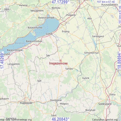
| Upper-left | 47.17299°, | 17.48269° |
| Center: | 46.69286°, | 18.18581° |
| Lower-right: | 46.20843°, | 18.88894° |
| Map W x H: | 107.2×107.2 km | = 66.6×66.6mi |
| max Lat: | 48.46667° ⇑80.4% North |
| Iregszemcse: | 46.69286° |
| min Lat: | ⇓19.6% South 45.79108° |
| min Long | Iregszemcse | max Long |
| 16.27358° | 18.18581° | 22.68096° |
| W 16.8%⇐ | ⇒83.2% E |
Elevation
Elevation of Iregszemcse is 163 m = 535 ft, and this is 33.3 m = 109 ft above average elevation for this country.
| Max E: |
444 m = 1457 ft | 18% |
| Iregszemcse | 163 m 535 ft | |
| Avg. | 129.7 m = 426 ft | |
Min E: |
71 m = 233 ft | 82% |
See also: Hungary elevation on elevation.city.
Geographical zone
Iregszemcse is located in North temperate zone (between Tropic of Cancer and the Arctic Circle). Distance of this North polar circle is 2209.4 km =1372.9 mi to North.| Distance of | km | miles | from Iregszemcse |
|---|---|---|---|
| North Pole | 4815.3 | 2992.1 | to North |
| Arctic Circle | 2209.4 | 1372.9 | to North |
| Tropic Cancer | 2585.8 | 1606.7 | to South |
| Equator | 5191.8 | 3226 | to South |


Nearby cities:
15 places around Iregszemcse: (largest is in red/bold)
• Balatonszabadi
22.7 km =14.1 mi,  350°
350°
• Dég
28 km =17.4 mi,  45°
45°
• Enying
26.8 km =16.7 mi,  9°
9°
• Gyönk
26.9 km =16.7 mi,  124°
124°
• Karád
26.3 km =16.3 mi,  269°
269°
• Lajoskomárom
20.2 km =12.6 mi,  34°
34°
• Mezőszilas
25.8 km =16 mi,  59°
59°
• Ozora
17.6 km =10.9 mi,  68°
68°
• Pincehely
19.4 km =12.1 mi,  93°
93°
• Siófok
25.4 km =15.8 mi,  337°
337°
• Szakcs
18.1 km =11.2 mi,  198°
198°
• Tab
12.5 km =7.8 mi,  290°
290°
• Tamási
10 km =6.2 mi,  131°
131°
• Zamárdi
27.7 km =17.2 mi,  320°
320°
• Ádánd
18.6 km =11.6 mi, 354°
Sources, notices
• [Note1] Compared only with cities in Hungary existing in our database
• [Src1] Map data: © OpenStreetMap contributors (CC-BY-SA)
• [Src2] Other city data from geonames.org with taken over terms of usage.
• [Src3] Geographical zone / Annual Mean Temperature by Robert A. Rohde @ Wikipedia
