Apala geodata
Apala (South Sulawesi) is a seat of a third-order administrative division; located in Indonesia in Asia/Makassar (GMT+8) time zone. In our database, there are 407 cities with bigger population. Compared to other cities in Indonesia, 89% of cities are located further ↓South; 83.7% of cities are located further ←West and 69.5% of cities have higher elevation than Apala. Note1


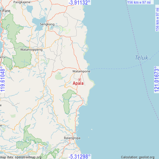
Apala GPS coordinates[2]
4° 36' 45" South, 120° 18' 48.96" East
| Map corner | latitude | longitude |
|---|---|---|
| Upper-left | -3.91132°, | 119.61048° |
| Center: | -4.6125°, | 120.3136° |
| Lower-right: | -5.31298°, | 121.01673° |
| Map W x H: | 155.8×155.9 km | = 96.8×96.9mi |
| max Lat: | 5.88969° ⇑11% North |
| Apala: | -4.6125° |
| min Lat: | ⇓89% South -10.934° |
| min Long | Apala | max Long |
| 95.1345° | 120.3136° | 140.9419° |
| W 83.7%⇐ | ⇒16.3% E |
Elevation
Elevation of Apala is 33 m = 108 ft, and this is 196.7 m = 645 ft below average elevation for this country.
| Max E: |
3185 m = 10449 ft | 69.5% |
| Avg. | 229.7 m = 754 ft | |
| Apala | 33 m = 108 ft | |
Min E: |
-1 m = -3 ft | 30.5% |
See also: Indonesia elevation on elevation.city.
Geographical zone
Apala is located in South Torrid zone (between Equator and Tropic of Capricorn). Distance of Equator is 512.9 km =318.7 mi to North.| Distance of | km | miles | from Apala |
|---|---|---|---|
| Equator | 512.9 | 318.7 | to North |
| Tropic Capricorn | 2093.1 | 1300.6 | to South |
| Antarctic Circle | 6888.3 | 4280.2 | to South |
| South Pole | 9494.2 | 5899.4 | to South |


Nearby cities:
15 places around Apala: (largest is in red/bold)
• Bulubulu
33.6 km =20.9 mi,  186°
186°
• Camming
34.3 km =21.3 mi,  229°
229°
• Jalang
63.9 km =39.7 mi,  0°
0°
• Kadai
22 km =13.7 mi,  171°
171°
• Kotabaru
55.7 km =34.6 mi,  322°
322°
• Maroanging
52.1 km =32.4 mi,  332°
332°
• Matango
33.7 km =20.9 mi,  260°
260°
• Palakka
9.4 km =5.8 mi,  343°
343°
• Palattae
45.7 km =28.4 mi,  209°
209°
• Pompanua
46.8 km =29.1 mi, 336°
• Sengkang
62.4 km =38.8 mi, 329°
• Sinjai
57.3 km =35.6 mi, 186°
• Taccipi
18.6 km =11.6 mi,  309°
309°
• Watampone
8.4 km =5.2 mi,  10°
10°
• Watansoppeng
55.7 km =34.6 mi,  301°
301°
Sources, notices
• [Note1] Compared only with cities in Indonesia existing in our database
• [Src1] Map data: © OpenStreetMap contributors (CC-BY-SA)
• [Src2] Other city data from geonames.org with taken over terms of usage.
• [Src3] Geographical zone / Annual Mean Temperature by Robert A. Rohde @ Wikipedia
