Tuktuk Sonak geodata
Tuktuk Sonak (North Sumatra) is a populated place; located in Indonesia in Asia/Jakarta (GMT+7) time zone. With population of 5,000 people, there are 386 cities with bigger population in this country. Compared to other cities in Indonesia, 97.7% of cities are located further ↓South; 98% of cities are located further →East and 96.5% of cities have lower elevation than Tuktuk Sonak. Note1


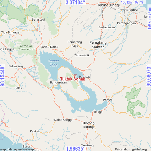
Tuktuk Sonak GPS coordinates[2]
2° 40' 8.04" North, 98° 51' 27.36" East
| Map corner | latitude | longitude |
|---|---|---|
| Upper-left | 3.37104°, | 98.15448° |
| Center: | 2.6689°, | 98.8576° |
| Lower-right: | 1.96635°, | 99.56073° |
| Map W x H: | 156.2×156.2 km | = 97.1×97.1mi |
| max Lat: | 5.88969° ⇑2.3% North |
| Tuktuk Sonak: | 2.6689° |
| min Lat: | ⇓97.7% South -10.934° |
| min Long | Tuktuk Sonak | max Long |
| 95.1345° | 98.8576° | 140.9419° |
| W 2%⇐ | ⇒98% E |
Elevation
Elevation of Tuktuk Sonak is 914 m = 2999 ft, and this is 684.3 m = 2245 ft above average elevation for this country.
| Max E: |
3185 m = 10449 ft | 3.5% |
| Tuktuk Sonak | 914 m 2999 ft | |
| Avg. | 229.7 m = 754 ft | |
Min E: |
-1 m = -3 ft | 96.5% |
See also: Indonesia elevation on elevation.city.
Geographical zone
Tuktuk Sonak is located in North Torrid zone (between Equator and Tropic of Cancer). Distance of Equator is 296.8 km =184.4 mi to South.| Distance of | km | miles | from Tuktuk Sonak |
|---|---|---|---|
| North Pole | 9710.3 | 6033.7 | to North |
| Arctic Circle | 7104.4 | 4414.5 | to North |
| Tropic Cancer | 2309.2 | 1434.9 | to North |
| Equator | 296.8 | 184.4 | to South |


Nearby cities:
15 places around Tuktuk Sonak: (largest is in red/bold)
• Ambarita
3.3 km =2.1 mi,  295°
295°
• Harian
25 km =15.5 mi,  239°
239°
• Mogang
22.9 km =14.2 mi,  194°
194°
• Muara
37.3 km =23.2 mi,  171°
171°
• Nainggolan
26.1 km =16.2 mi, 173°
• Pane Tongah
29.3 km =18.2 mi,  25°
25°
• Pangururan
19.2 km =11.9 mi,  249°
249°
• Parapat
8.6 km =5.3 mi,  94°
94°
• Pematang Raya
33 km =20.5 mi,  358°
358°
• Pematangsiantar
39.9 km =24.8 mi,  35°
35°
• Sarimatondang
22.6 km =14 mi,  16°
16°
• Sipintuangin
17.7 km =11 mi,  335°
335°
• Sondi
33.9 km =21.1 mi,  0°
0°
• Tigarunggu
29.4 km =18.3 mi,  329°
329°
• Tomok Bolon
1.9 km =1.2 mi, 169°
Sources, notices
• [Note1] Compared only with cities in Indonesia existing in our database
• [Src1] Map data: © OpenStreetMap contributors (CC-BY-SA)
• [Src2] Other city data from geonames.org with taken over terms of usage.
• [Src3] Geographical zone / Annual Mean Temperature by Robert A. Rohde @ Wikipedia
