Bomomani geodata
Bomomani (Papua) is a seat of a third-order administrative division; located in Indonesia in Asia/Jayapura (GMT+9) time zone. In our database, there are 407 cities with bigger population. Compared to other cities in Indonesia, 89.3% of cities are located further ↓South; 99.3% of cities are located further ←West and 98.6% of cities have lower elevation than Bomomani. Note1


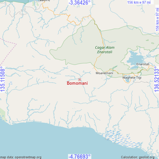
Bomomani GPS coordinates[2]
4° 3' 57.24" South, 135° 49' 5.52" East
| Map corner | latitude | longitude |
|---|---|---|
| Upper-left | -3.36426°, | 135.11508° |
| Center: | -4.0659°, | 135.8182° |
| Lower-right: | -4.76693°, | 136.52133° |
| Map W x H: | 156×156 km | = 96.9×96.9mi |
| max Lat: | 5.88969° ⇑10.7% North |
| Bomomani: | -4.0659° |
| min Lat: | ⇓89.3% South -10.934° |
| min Long | Bomomani | max Long |
| 95.1345° | 135.8182° | 140.9419° |
| W 99.3%⇐ | ⇒0.7% E |
Elevation
Elevation of Bomomani is 1129 m = 3704 ft, and this is 899.3 m = 2950 ft above average elevation for this country.
| Max E: |
3185 m = 10449 ft | 1.4% |
| Bomomani | 1129 m 3704 ft | |
| Avg. | 229.7 m = 754 ft | |
Min E: |
-1 m = -3 ft | 98.6% |
See also: Indonesia elevation on elevation.city.
Geographical zone
Bomomani is located in South Torrid zone (between Equator and Tropic of Capricorn). Distance of Equator is 452.1 km =280.9 mi to North.| Distance of | km | miles | from Bomomani |
|---|---|---|---|
| Equator | 452.1 | 280.9 | to North |
| Tropic Capricorn | 2153.8 | 1338.3 | to South |
| Antarctic Circle | 6949.1 | 4318 | to South |
| South Pole | 9555 | 5937.2 | to South |


Nearby cities:
15 places around Bomomani: (largest is in red/bold)
• Bilogai
101.9 km =63.3 mi,  67°
67°
• Enarotali
63.7 km =39.6 mi,  76°
76°
• Homeyo
85 km =52.8 mi,  58°
58°
• Kigamani
18.1 km =11.2 mi,  50°
50°
• Kiruru
95.2 km =59.2 mi,  278°
278°
• Kumopa
81.3 km =50.5 mi, 70°
• Kwantisore
134.8 km =83.8 mi,  311°
311°
• Mapurujaya
131 km =81.4 mi,  121°
121°
• Moanemani
34.3 km =21.3 mi, 71°
• Nabire
86 km =53.4 mi,  335°
335°
• Obano
47.8 km =29.7 mi, 71°
• Tigi
51 km =31.7 mi, 77°
• Topo
66.2 km =41.1 mi,  331°
331°
• Uta
59.3 km =36.8 mi,  156°
156°
• Waghete
50.7 km =31.5 mi,  86°
86°
Sources, notices
• [Note1] Compared only with cities in Indonesia existing in our database
• [Src1] Map data: © OpenStreetMap contributors (CC-BY-SA)
• [Src2] Other city data from geonames.org with taken over terms of usage.
• [Src3] Geographical zone / Annual Mean Temperature by Robert A. Rohde @ Wikipedia
