Mapurujaya geodata
Mapurujaya (Papua) is a seat of a third-order administrative division; located in Indonesia in Asia/Jayapura (GMT+9) time zone. In our database, there are 407 cities with bigger population. Compared to other cities in Indonesia, 88.9% of cities are located further ↓South; 99.5% of cities are located further ←West and 89% of cities have higher elevation than Mapurujaya. Note1


Mapurujaya GPS coordinates[2]
4° 40' 30.72" South, 136° 49' 46.92" East
| Map corner | latitude | longitude |
|---|---|---|
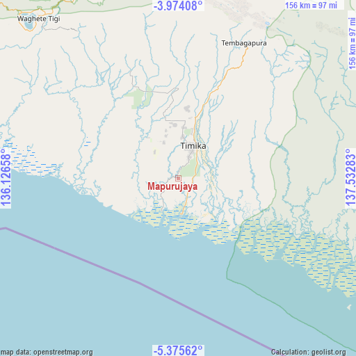
| Upper-left | -3.97408°, | 136.12658° |
| Center: | -4.6752°, | 136.8297° |
| Lower-right: | -5.37562°, | 137.53283° |
| Map W x H: | 155.8×155.8 km | = 96.8×96.8mi |
| max Lat: | 5.88969° ⇑11.1% North |
| Mapurujaya: | -4.6752° |
| min Lat: | ⇓88.9% South -10.934° |
| min Long | Mapurujaya | max Long |
| 95.1345° | 136.8297° | 140.9419° |
| W 99.5%⇐ | ⇒0.5% E |
Elevation
Elevation of Mapurujaya is 11 m = 36 ft, and this is 218.7 m = 718 ft below average elevation for this country.
| Max E: |
3185 m = 10449 ft | 89% |
| Avg. | 229.7 m = 754 ft | |
| Mapurujaya | 11 m = 36 ft | |
Min E: |
-1 m = -3 ft | 11% |
See also: Indonesia elevation on elevation.city.
Geographical zone
Mapurujaya is located in South Torrid zone (between Equator and Tropic of Capricorn). Distance of Equator is 519.8 km =323 mi to North.| Distance of | km | miles | from Mapurujaya |
|---|---|---|---|
| Equator | 519.8 | 323 | to North |
| Tropic Capricorn | 2086.1 | 1296.2 | to South |
| Antarctic Circle | 6881.3 | 4275.8 | to South |
| South Pole | 9487.2 | 5895.1 | to South |


Nearby cities:
15 places around Mapurujaya: (largest is in red/bold)
• Beoga
100.2 km =62.3 mi,  21°
21°
• Bilogai
107.9 km =67 mi,  350°
350°
• Bomomani
131 km =81.4 mi,  301°
301°
• Enarotali
96.9 km =60.2 mi,  328°
328°
• Homeyo
119.4 km =74.2 mi,  340°
340°
• Ilaga
102.5 km =63.7 mi,  38°
38°
• Kigamani
126.3 km =78.5 mi,  308°
308°
• Kumopa
101.3 km =62.9 mi, 339°
• Moanemani
111.9 km =69.5 mi, 314°
• Mulia
166.8 km =103.6 mi,  50°
50°
• Obano
106.9 km =66.4 mi,  321°
321°
• Sugapa
106.5 km =66.2 mi,  13°
13°
• Tigi
100.5 km =62.4 mi, 321°
• Uta
89.2 km =55.4 mi,  278°
278°
• Waghete
93.7 km =58.2 mi, 318°
Sources, notices
• [Note1] Compared only with cities in Indonesia existing in our database
• [Src1] Map data: © OpenStreetMap contributors (CC-BY-SA)
• [Src2] Other city data from geonames.org with taken over terms of usage.
• [Src3] Geographical zone / Annual Mean Temperature by Robert A. Rohde @ Wikipedia
