Uta geodata
Uta (Papua) is a seat of a third-order administrative division; located in Indonesia in Asia/Jayapura (GMT+9) time zone. In our database, there are 407 cities with bigger population. Compared to other cities in Indonesia, 89% of cities are located further ↓South; 99.3% of cities are located further ←West and 78.9% of cities have higher elevation than Uta. Note1


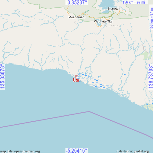
Uta GPS coordinates[2]
4° 33' 12.96" South, 136° 2' 2.04" East
| Map corner | latitude | longitude |
|---|---|---|
| Upper-left | -3.85237°, | 135.33078° |
| Center: | -4.5536°, | 136.0339° |
| Lower-right: | -5.25415°, | 136.73703° |
| Map W x H: | 155.9×155.9 km | = 96.9×96.9mi |
| max Lat: | 5.88969° ⇑11% North |
| Uta: | -4.5536° |
| min Lat: | ⇓89% South -10.934° |
| min Long | Uta | max Long |
| 95.1345° | 136.0339° | 140.9419° |
| W 99.3%⇐ | ⇒0.7% E |
Elevation
Elevation of Uta is 20 m = 66 ft, and this is 209.7 m = 688 ft below average elevation for this country.
| Max E: |
3185 m = 10449 ft | 78.9% |
| Avg. | 229.7 m = 754 ft | |
| Uta | 20 m = 66 ft | |
Min E: |
-1 m = -3 ft | 21.1% |
See also: Indonesia elevation on elevation.city.
Geographical zone
Uta is located in South Torrid zone (between Equator and Tropic of Capricorn). Distance of Equator is 506.3 km =314.6 mi to North.| Distance of | km | miles | from Uta |
|---|---|---|---|
| Equator | 506.3 | 314.6 | to North |
| Tropic Capricorn | 2099.6 | 1304.6 | to South |
| Antarctic Circle | 6894.9 | 4284.3 | to South |
| South Pole | 9500.7 | 5903.5 | to South |


Nearby cities:
15 places around Uta: (largest is in red/bold)
• Bilogai
116.5 km =72.4 mi,  37°
37°
• Bomomani
59.3 km =36.8 mi,  336°
336°
• Enarotali
79 km =49.1 mi,  28°
28°
• Homeyo
110.2 km =68.5 mi, 25°
• Kigamani
66.6 km =41.4 mi,  351°
351°
• Kiruru
136.4 km =84.8 mi,  300°
300°
• Kumopa
97 km =60.3 mi, 32°
• Mapurujaya
89.2 km =55.4 mi,  98°
98°
• Moanemani
65.7 km =40.8 mi,  7°
7°
• Nabire
145.3 km =90.3 mi, 335°
• Obano
73 km =45.4 mi,  16°
16°
• Sugapa
144.3 km =89.7 mi,  51°
51°
• Tigi
70.2 km =43.6 mi, 21°
• Topo
125.4 km =77.9 mi,  333°
333°
• Waghete
63.1 km =39.2 mi, 25°
Sources, notices
• [Note1] Compared only with cities in Indonesia existing in our database
• [Src1] Map data: © OpenStreetMap contributors (CC-BY-SA)
• [Src2] Other city data from geonames.org with taken over terms of usage.
• [Src3] Geographical zone / Annual Mean Temperature by Robert A. Rohde @ Wikipedia
