Geumpang geodata
Geumpang (Aceh) is a seat of a third-order administrative division; located in Indonesia in Asia/Jakarta (GMT+7) time zone. In our database, there are 407 cities with bigger population. Compared to other cities in Indonesia, 99.4% of cities are located further ↓South; 99.5% of cities are located further →East and 90.3% of cities have lower elevation than Geumpang. Note1


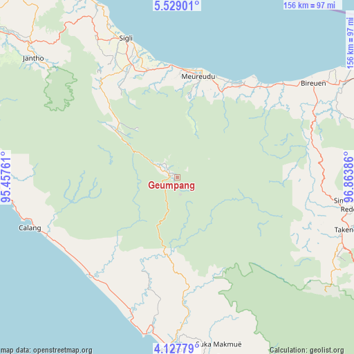
Geumpang GPS coordinates[2]
4° 49' 43.536" North, 96° 9' 38.628" East
| Map corner | latitude | longitude |
|---|---|---|
| Upper-left | 5.52901°, | 95.45761° |
| Center: | 4.82876°, | 96.16073° |
| Lower-right: | 4.12779°, | 96.86386° |
| Map W x H: | 155.8×155.8 km | = 96.8×96.8mi |
| max Lat: | 5.88969° ⇑0.6% North |
| Geumpang: | 4.82876° |
| min Lat: | ⇓99.4% South -10.934° |
| min Long | Geumpang | max Long |
| 95.1345° | 96.16073° | 140.9419° |
| W 0.5%⇐ | ⇒99.5% E |
Elevation
Elevation of Geumpang is 650 m = 2133 ft, and this is 420.3 m = 1379 ft above average elevation for this country.
| Max E: |
3185 m = 10449 ft | 9.7% |
| Geumpang | 650 m 2133 ft | |
| Avg. | 229.7 m = 754 ft | |
Min E: |
-1 m = -3 ft | 90.3% |
See also: Indonesia elevation on elevation.city.
Geographical zone
Geumpang is located in North Torrid zone (between Equator and Tropic of Cancer). Distance of Equator is 536.9 km =333.6 mi to South.| Distance of | km | miles | from Geumpang |
|---|---|---|---|
| North Pole | 9470.2 | 5884.5 | to North |
| Arctic Circle | 6864.3 | 4265.3 | to North |
| Tropic Cancer | 2069 | 1285.6 | to North |
| Equator | 536.9 | 333.6 | to South |


Nearby cities:
15 places around Geumpang: (largest is in red/bold)
• Geuleumpangminyeuk
49.1 km =30.5 mi,  342°
342°
• Kajeung
35.2 km =21.9 mi,  185°
185°
• Keumala
53.6 km =33.3 mi,  330°
330°
• Kuala Bhee
50.9 km =31.6 mi, 194°
• Lueng Putu
49 km =30.4 mi,  346°
346°
• Mane
21 km =13 mi,  305°
305°
• Pantai Ceuremen
51.3 km =31.9 mi,  175°
175°
• Pante Raja
46.3 km =28.8 mi,  358°
358°
• Reuleuet
45.2 km =28.1 mi,  17°
17°
• Rusip
52.9 km =32.9 mi,  109°
109°
• Tangse
34.1 km =21.2 mi, 307°
• Tiro
47.4 km =29.5 mi, 328°
• Trienggadeng
46 km =28.6 mi,  5°
5°
• Ulee Gle
45.5 km =28.3 mi, 23°
• Uleeglee
45.3 km =28.1 mi,  27°
27°
Sources, notices
• [Note1] Compared only with cities in Indonesia existing in our database
• [Src1] Map data: © OpenStreetMap contributors (CC-BY-SA)
• [Src2] Other city data from geonames.org with taken over terms of usage.
• [Src3] Geographical zone / Annual Mean Temperature by Robert A. Rohde @ Wikipedia
