Kayan Hulu geodata
Kayan Hulu (North Kalimantan) is a seat of a third-order administrative division; located in Indonesia in Asia/Makassar (GMT+8) time zone. In our database, there are 407 cities with bigger population. Compared to other cities in Indonesia, 98.7% of cities are located further ↓South; 75.8% of cities are located further ←West and 94.4% of cities have lower elevation than Kayan Hulu. Note1


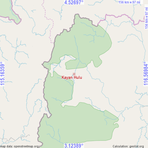
Kayan Hulu GPS coordinates[2]
3° 49' 32.592" North, 115° 52' 0.156" East
| Map corner | latitude | longitude |
|---|---|---|
| Upper-left | 4.52697°, | 115.16359° |
| Center: | 3.82572°, | 115.86671° |
| Lower-right: | 3.12389°, | 116.56984° |
| Map W x H: | 156×156 km | = 96.9×96.9mi |
| max Lat: | 5.88969° ⇑1.3% North |
| Kayan Hulu: | 3.82572° |
| min Lat: | ⇓98.7% South -10.934° |
| min Long | Kayan Hulu | max Long |
| 95.1345° | 115.86671° | 140.9419° |
| W 75.8%⇐ | ⇒24.2% E |
Elevation
Elevation of Kayan Hulu is 785 m = 2575 ft, and this is 555.3 m = 1822 ft above average elevation for this country.
| Max E: |
3185 m = 10449 ft | 5.6% |
| Kayan Hulu | 785 m 2575 ft | |
| Avg. | 229.7 m = 754 ft | |
Min E: |
-1 m = -3 ft | 94.4% |
See also: Indonesia elevation on elevation.city.
Geographical zone
Kayan Hulu is located in North Torrid zone (between Equator and Tropic of Cancer). Distance of Equator is 425.4 km =264.3 mi to South.| Distance of | km | miles | from Kayan Hulu |
|---|---|---|---|
| North Pole | 9581.7 | 5953.8 | to North |
| Arctic Circle | 6975.8 | 4334.6 | to North |
| Tropic Cancer | 2180.5 | 1354.9 | to North |
| Equator | 425.4 | 264.3 | to South |


Nearby cities:
15 places around Kayan Hulu: (largest is in red/bold)
• Atap
130.9 km =81.3 mi,  88°
88°
• Kerangagung
175.7 km =109.2 mi,  121°
121°
• Long Bang
158.4 km =98.4 mi,  133°
133°
• Long Beluah
180.2 km =112 mi, 131°
• Long Layu
30.3 km =18.8 mi,  217°
217°
• Long Loreh
99.2 km =61.6 mi,  137°
137°
• Long Peso
162.3 km =100.8 mi, 141°
• Long Pujungan
137.9 km =85.7 mi,  183°
183°
• Malinau
88.1 km =54.7 mi,  107°
107°
• Mensalong
97.8 km =60.8 mi, 94°
• Mentarang
41.4 km =25.7 mi, 126°
• Sebuku
131 km =81.4 mi,  81°
81°
• Sekatak Bengara
170.5 km =105.9 mi, 118°
• Sesayap
129.4 km =80.4 mi,  101°
101°
• Tideng Pale
117.9 km =73.3 mi, 101°
Sources, notices
• [Note1] Compared only with cities in Indonesia existing in our database
• [Src1] Map data: © OpenStreetMap contributors (CC-BY-SA)
• [Src2] Other city data from geonames.org with taken over terms of usage.
• [Src3] Geographical zone / Annual Mean Temperature by Robert A. Rohde @ Wikipedia
