Long Pujungan geodata
Long Pujungan (North Kalimantan) is a seat of a third-order administrative division; located in Indonesia in Asia/Makassar (GMT+8) time zone. In our database, there are 407 cities with bigger population. Compared to other cities in Indonesia, 97.6% of cities are located further ↓South; 75.8% of cities are located further ←West and 67.2% of cities have lower elevation than Long Pujungan. Note1


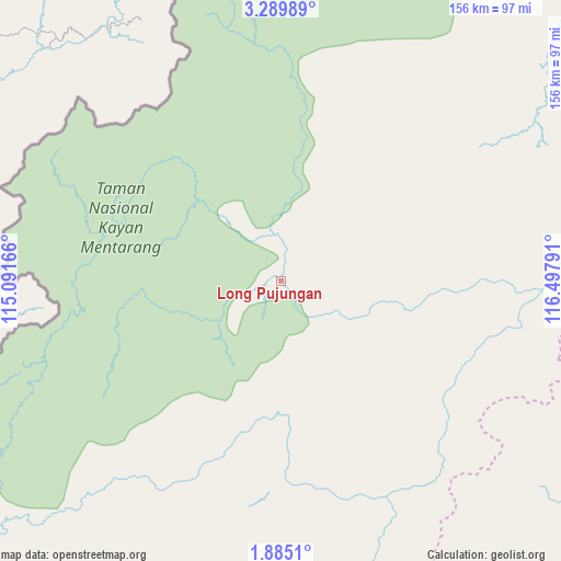
Long Pujungan GPS coordinates[2]
2° 35' 15.684" North, 115° 47' 41.208" East
| Map corner | latitude | longitude |
|---|---|---|
| Upper-left | 3.28989°, | 115.09166° |
| Center: | 2.58769°, | 115.79478° |
| Lower-right: | 1.8851°, | 116.49791° |
| Map W x H: | 156.2×156.2 km | = 97.1×97.1mi |
| max Lat: | 5.88969° ⇑2.4% North |
| Long Pujungan: | 2.58769° |
| min Lat: | ⇓97.6% South -10.934° |
| min Long | Long Pujungan | max Long |
| 95.1345° | 115.79478° | 140.9419° |
| W 75.8%⇐ | ⇒24.2% E |
Elevation
Elevation of Long Pujungan is 254 m = 833 ft, and this is 24.3 m = 80 ft above average elevation for this country.
| Max E: |
3185 m = 10449 ft | 32.8% |
| Long Pujungan | 254 m 833 ft | |
| Avg. | 229.7 m = 754 ft | |
Min E: |
-1 m = -3 ft | 67.2% |
See also: Indonesia elevation on elevation.city.
Geographical zone
Long Pujungan is located in North Torrid zone (between Equator and Tropic of Cancer). Distance of Equator is 287.7 km =178.8 mi to South.| Distance of | km | miles | from Long Pujungan |
|---|---|---|---|
| North Pole | 9719.3 | 6039.3 | to North |
| Arctic Circle | 7113.4 | 4420.1 | to North |
| Tropic Cancer | 2318.2 | 1440.5 | to North |
| Equator | 287.7 | 178.8 | to South |


Nearby cities:
15 places around Long Pujungan: (largest is in red/bold)
• Data Dian
87.1 km =54.1 mi,  223°
223°
• Kayan Hulu
137.9 km =85.7 mi,  3°
3°
• Kerangagung
164.5 km =102.2 mi,  73°
73°
• Long Bang
126.6 km =78.7 mi,  76°
76°
• Long Beluah
145 km =90.1 mi, 82°
• Long Layu
114.2 km =71 mi,  354°
354°
• Long Loreh
98.9 km =61.5 mi,  49°
49°
• Long Peso
110.6 km =68.7 mi, 84°
• Longnawang
133.2 km =82.8 mi,  228°
228°
• Malinau
144.4 km =89.7 mi,  39°
39°
• Mensalong
167.6 km =104.1 mi, 39°
• Mentarang
120.6 km =74.9 mi,  20°
20°
• Sekatak Bengara
167.1 km =103.8 mi, 70°
• Sungaiboh
122.6 km =76.2 mi,  210°
210°
• Tideng Pale
167.7 km =104.2 mi, 47°
Sources, notices
• [Note1] Compared only with cities in Indonesia existing in our database
• [Src1] Map data: © OpenStreetMap contributors (CC-BY-SA)
• [Src2] Other city data from geonames.org with taken over terms of usage.
• [Src3] Geographical zone / Annual Mean Temperature by Robert A. Rohde @ Wikipedia
