Atap geodata
Atap (North Kalimantan) is a seat of a third-order administrative division; located in Indonesia in Asia/Makassar (GMT+8) time zone. In our database, there are 407 cities with bigger population. Compared to other cities in Indonesia, 98.7% of cities are located further ↓South; 78.5% of cities are located further ←West and 95.5% of cities have higher elevation than Atap. Note1


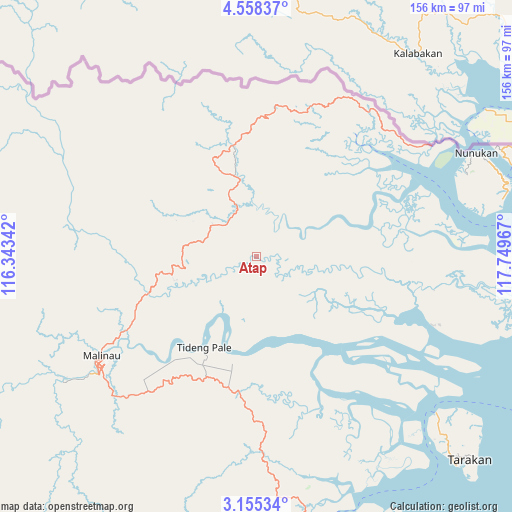
Atap GPS coordinates[2]
3° 51' 25.704" North, 117° 2' 47.544" East
| Map corner | latitude | longitude |
|---|---|---|
| Upper-left | 4.55837°, | 116.34342° |
| Center: | 3.85714°, | 117.04654° |
| Lower-right: | 3.15534°, | 117.74967° |
| Map W x H: | 156×156 km | = 96.9×96.9mi |
| max Lat: | 5.88969° ⇑1.3% North |
| Atap: | 3.85714° |
| min Lat: | ⇓98.7% South -10.934° |
| min Long | Atap | max Long |
| 95.1345° | 117.04654° | 140.9419° |
| W 78.5%⇐ | ⇒21.5% E |
Elevation
Elevation of Atap is 7 m = 23 ft, and this is 222.7 m = 731 ft below average elevation for this country.
| Max E: |
3185 m = 10449 ft | 95.5% |
| Avg. | 229.7 m = 754 ft | |
| Atap | 7 m = 23 ft | |
Min E: |
-1 m = -3 ft | 4.5% |
See also: Indonesia elevation on elevation.city.
Geographical zone
Atap is located in North Torrid zone (between Equator and Tropic of Cancer). Distance of Equator is 428.9 km =266.5 mi to South.| Distance of | km | miles | from Atap |
|---|---|---|---|
| North Pole | 9578.2 | 5951.6 | to North |
| Arctic Circle | 6972.3 | 4332.4 | to North |
| Tropic Cancer | 2177 | 1352.7 | to North |
| Equator | 428.9 | 266.5 | to South |


Nearby cities:
15 places around Atap: (largest is in red/bold)
• Binalawan
84.7 km =52.6 mi,  72°
72°
• Kerangagung
97 km =60.3 mi,  168°
168°
• Long Bang
113.3 km =70.4 mi,  187°
187°
• Long Loreh
99.8 km =62 mi,  219°
219°
• Malinau
55.6 km =34.5 mi,  237°
237°
• Mensalong
35.2 km =21.9 mi,  251°
251°
• Mentarang
101.4 km =63 mi, 254°
• Salinbatu
107.1 km =66.5 mi,  162°
162°
• Sebuku
16.2 km =10.1 mi,  355°
355°
• Sekatak Bengara
87.6 km =54.4 mi, 167°
• Sesayap
30.5 km =19 mi, 188°
• Sungai Nyamuk
101 km =62.8 mi, 71°
• Tanjung Selor
118.8 km =73.8 mi, 162°
• Tarakan
85.5 km =53.1 mi,  134°
134°
• Tideng Pale
31.7 km =19.7 mi,  209°
209°
Sources, notices
• [Note1] Compared only with cities in Indonesia existing in our database
• [Src1] Map data: © OpenStreetMap contributors (CC-BY-SA)
• [Src2] Other city data from geonames.org with taken over terms of usage.
• [Src3] Geographical zone / Annual Mean Temperature by Robert A. Rohde @ Wikipedia
