Labungkari geodata
Labungkari (Southeast Sulawesi) is a seat of a second-order administrative division; located in Indonesia in Asia/Makassar (GMT+8) time zone. In our database, there are 407 cities with bigger population. Compared to other cities in Indonesia, 88.5% of cities are located further ↓South; 89% of cities are located further ←West and 74.9% of cities have higher elevation than Labungkari. Note1


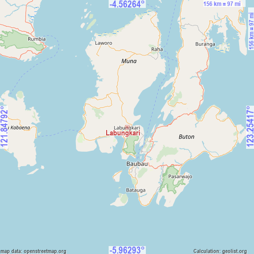
Labungkari GPS coordinates[2]
5° 15' 47.448" South, 122° 33' 3.744" East
| Map corner | latitude | longitude |
|---|---|---|
| Upper-left | -4.56264°, | 121.84792° |
| Center: | -5.26318°, | 122.55104° |
| Lower-right: | -5.96293°, | 123.25417° |
| Map W x H: | 155.7×155.7 km | = 96.7×96.7mi |
| max Lat: | 5.88969° ⇑11.5% North |
| Labungkari: | -5.26318° |
| min Lat: | ⇓88.5% South -10.934° |
| min Long | Labungkari | max Long |
| 95.1345° | 122.55104° | 140.9419° |
| W 89%⇐ | ⇒11% E |
Elevation
Elevation of Labungkari is 25 m = 82 ft, and this is 204.7 m = 672 ft below average elevation for this country.
| Max E: |
3185 m = 10449 ft | 74.9% |
| Avg. | 229.7 m = 754 ft | |
| Labungkari | 25 m = 82 ft | |
Min E: |
-1 m = -3 ft | 25.1% |
See also: Indonesia elevation on elevation.city.
Geographical zone
Labungkari is located in South Torrid zone (between Equator and Tropic of Capricorn). Distance of Equator is 585.2 km =363.6 mi to North.| Distance of | km | miles | from Labungkari |
|---|---|---|---|
| Equator | 585.2 | 363.6 | to North |
| Tropic Capricorn | 2020.7 | 1255.6 | to South |
| Antarctic Circle | 6816 | 4235.3 | to South |
| South Pole | 9421.9 | 5854.5 | to South |


Nearby cities:
15 places around Labungkari: (largest is in red/bold)
• Andoolo
109.2 km =67.9 mi,  342°
342°
• Batauga
36.5 km =22.7 mi,  172°
172°
• Buranga
70.2 km =43.6 mi,  42°
42°
• Katabu
36.9 km =22.9 mi,  354°
354°
• Kendari
143 km =88.9 mi,  358°
358°
• Kolaka
170 km =105.6 mi,  321°
321°
• Langara
146.1 km =90.8 mi,  19°
19°
• Lasehao
29.2 km =18.1 mi, 347°
• Laworo
53.4 km =33.2 mi, 356°
• Munse
151.2 km =94 mi,  30°
30°
• Pasar Wajo
41.5 km =25.8 mi,  128°
128°
• Raha
50.9 km =31.6 mi, 21°
• Rumbia
93 km =57.8 mi, 319°
• Unaaha
166.5 km =103.5 mi, 340°
• Wanci
109.6 km =68.1 mi,  93°
93°
Sources, notices
• [Note1] Compared only with cities in Indonesia existing in our database
• [Src1] Map data: © OpenStreetMap contributors (CC-BY-SA)
• [Src2] Other city data from geonames.org with taken over terms of usage.
• [Src3] Geographical zone / Annual Mean Temperature by Robert A. Rohde @ Wikipedia
