Unaaha geodata
Unaaha (Southeast Sulawesi) is a seat of a second-order administrative division; located in Indonesia in Asia/Makassar (GMT+8) time zone. In our database, there are 407 cities with bigger population. Compared to other cities in Indonesia, 89.7% of cities are located further ↓South; 88.2% of cities are located further ←West and 66.8% of cities have higher elevation than Unaaha. Note1


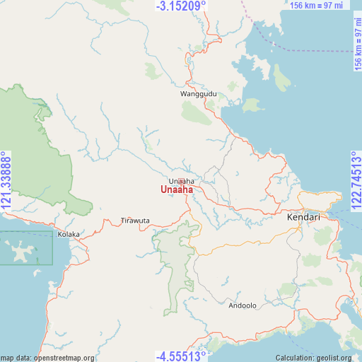
Unaaha GPS coordinates[2]
3° 51' 14.04" South, 122° 2' 31.2" East
| Map corner | latitude | longitude |
|---|---|---|
| Upper-left | -3.15209°, | 121.33888° |
| Center: | -3.8539°, | 122.042° |
| Lower-right: | -4.55513°, | 122.74513° |
| Map W x H: | 156×156 km | = 96.9×96.9mi |
| max Lat: | 5.88969° ⇑10.3% North |
| Unaaha: | -3.8539° |
| min Lat: | ⇓89.7% South -10.934° |
| min Long | Unaaha | max Long |
| 95.1345° | 122.042° | 140.9419° |
| W 88.2%⇐ | ⇒11.8% E |
Elevation
Elevation of Unaaha is 38 m = 125 ft, and this is 191.7 m = 629 ft below average elevation for this country.
| Max E: |
3185 m = 10449 ft | 66.8% |
| Avg. | 229.7 m = 754 ft | |
| Unaaha | 38 m = 125 ft | |
Min E: |
-1 m = -3 ft | 33.2% |
See also: Indonesia elevation on elevation.city.
Geographical zone
Unaaha is located in South Torrid zone (between Equator and Tropic of Capricorn). Distance of Equator is 428.5 km =266.3 mi to North.| Distance of | km | miles | from Unaaha |
|---|---|---|---|
| Equator | 428.5 | 266.3 | to North |
| Tropic Capricorn | 2177.4 | 1353 | to South |
| Antarctic Circle | 6972.7 | 4332.6 | to South |
| South Pole | 9578.5 | 5951.8 | to South |


Nearby cities:
15 places around Unaaha: (largest is in red/bold)
• Andoolo
57.6 km =35.8 mi,  156°
156°
• Asera
42.3 km =26.3 mi,  3°
3°
• Bungku
145.5 km =90.4 mi,  356°
356°
• Buranga
148.2 km =92.1 mi,  135°
135°
• Katabu
131 km =81.4 mi, 156°
• Kendari
54.3 km =33.7 mi,  104°
104°
• Kolaka
53.5 km =33.2 mi,  244°
244°
• Labungkari
166.5 km =103.5 mi, 160°
• Langara
106.9 km =66.4 mi, 100°
• Lasehao
137.6 km =85.5 mi, 158°
• Lasusua
134 km =83.3 mi,  286°
286°
• Laworo
116.4 km =72.3 mi,  152°
152°
• Munse
136.9 km =85.1 mi, 101°
• Raha
132.8 km =82.5 mi, 145°
• Rumbia
86.1 km =53.5 mi,  182°
182°
Sources, notices
• [Note1] Compared only with cities in Indonesia existing in our database
• [Src1] Map data: © OpenStreetMap contributors (CC-BY-SA)
• [Src2] Other city data from geonames.org with taken over terms of usage.
• [Src3] Geographical zone / Annual Mean Temperature by Robert A. Rohde @ Wikipedia
