Tiom geodata
Tiom (Papua) is a seat of a second-order administrative division; located in Indonesia in Asia/Jayapura (GMT+9) time zone. In our database, there are 407 cities with bigger population. Compared to other cities in Indonesia, 89.6% of cities are located further ↓South; 99.6% of cities are located further ←West and 99.9% of cities have lower elevation than Tiom. Note1


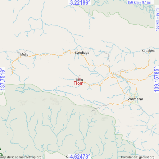
Tiom GPS coordinates[2]
3° 55' 24.996" South, 138° 27' 16.992" East
| Map corner | latitude | longitude |
|---|---|---|
| Upper-left | -3.22186°, | 137.7516° |
| Center: | -3.92361°, | 138.45472° |
| Lower-right: | -4.62478°, | 139.15785° |
| Map W x H: | 156×156 km | = 96.9×96.9mi |
| max Lat: | 5.88969° ⇑10.4% North |
| Tiom: | -3.92361° |
| min Lat: | ⇓89.6% South -10.934° |
| min Long | Tiom | max Long |
| 95.1345° | 138.45472° | 140.9419° |
| W 99.6%⇐ | ⇒0.40000000000001% E |
Elevation
Elevation of Tiom is 2116 m = 6942 ft, and this is 1886.3 m = 6189 ft above average elevation for this country.
| Max E: |
3185 m = 10449 ft | 0.099999999999994% |
| Tiom | 2116 m 6942 ft | |
| Avg. | 229.7 m = 754 ft | |
Min E: |
-1 m = -3 ft | 99.9% |
See also: Indonesia elevation on elevation.city.
Geographical zone
Tiom is located in South Torrid zone (between Equator and Tropic of Capricorn). Distance of Equator is 436.3 km =271.1 mi to North.| Distance of | km | miles | from Tiom |
|---|---|---|---|
| Equator | 436.3 | 271.1 | to North |
| Tropic Capricorn | 2169.7 | 1348.2 | to South |
| Antarctic Circle | 6964.9 | 4327.8 | to South |
| South Pole | 9570.8 | 5947 | to South |


Nearby cities:
15 places around Tiom: (largest is in red/bold)
• Agats
183.7 km =114.1 mi,  191°
191°
• Beoga
143.2 km =89 mi,  273°
273°
• Bikondini
32.4 km =20.1 mi,  24°
24°
• Burmeso
183.5 km =114 mi,  345°
345°
• Dabra
76.9 km =47.8 mi,  11°
11°
• Elelim
140.2 km =87.1 mi,  82°
82°
• Ilaga
117 km =72.7 mi, 268°
• Karubaga
24.9 km =15.5 mi,  0°
0°
• Kenyam
75.6 km =47 mi, 185°
• Kobakma
73.6 km =45.7 mi,  66°
66°
• Mulia
57 km =35.4 mi,  294°
294°
• Sugapa
157.1 km =97.6 mi,  277°
277°
• Sumohai
131.2 km =81.5 mi,  130°
130°
• Wamena
57.6 km =35.8 mi,  109°
109°
• Wurigelebur
43.1 km =26.8 mi, 65°
Sources, notices
• [Note1] Compared only with cities in Indonesia existing in our database
• [Src1] Map data: © OpenStreetMap contributors (CC-BY-SA)
• [Src2] Other city data from geonames.org with taken over terms of usage.
• [Src3] Geographical zone / Annual Mean Temperature by Robert A. Rohde @ Wikipedia
