Sembalunlawang geodata
Sembalunlawang (West Nusa Tenggara) is a seat of a fourth-order administrative division; located in Indonesia in Asia/Makassar (GMT+8) time zone. In our database, there are 407 cities with bigger population. Compared to other cities in Indonesia, 79.1% of cities are located further ↑North; 77.8% of cities are located further ←West and 98.7% of cities have lower elevation than Sembalunlawang. Note1


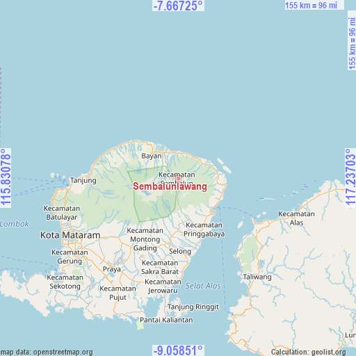
Sembalunlawang GPS coordinates[2]
8° 21' 48.6" South, 116° 32' 2.04" East
| Map corner | latitude | longitude |
|---|---|---|
| Upper-left | -7.66725°, | 115.83078° |
| Center: | -8.3635°, | 116.5339° |
| Lower-right: | -9.05851°, | 117.23703° |
| Map W x H: | 154.7×154.7 km | = 96.1×96.1mi |
| max Lat: | 5.88969° ⇑79.1% North |
| Sembalunlawang: | -8.3635° |
| min Lat: | ⇓20.9% South -10.934° |
| min Long | Sembalunlawang | max Long |
| 95.1345° | 116.5339° | 140.9419° |
| W 77.8%⇐ | ⇒22.2% E |
Elevation
Elevation of Sembalunlawang is 1165 m = 3822 ft, and this is 935.3 m = 3069 ft above average elevation for this country.
| Max E: |
3185 m = 10449 ft | 1.3% |
| Sembalunlawang | 1165 m 3822 ft | |
| Avg. | 229.7 m = 754 ft | |
Min E: |
-1 m = -3 ft | 98.7% |
See also: Indonesia elevation on elevation.city.
Geographical zone
Sembalunlawang is located in South Torrid zone (between Equator and Tropic of Capricorn). Distance of Equator is 929.9 km =577.8 mi to North.| Distance of | km | miles | from Sembalunlawang |
|---|---|---|---|
| Equator | 929.9 | 577.8 | to North |
| Tropic Capricorn | 1676 | 1041.4 | to South |
| Antarctic Circle | 6471.2 | 4021 | to South |
| South Pole | 9077.1 | 5640.2 | to South |


Nearby cities:
15 places around Sembalunlawang: (largest is in red/bold)
• Anyar
19.1 km =11.9 mi,  321°
321°
• Batubasong Lauk
19 km =11.8 mi,  163°
163°
• Bayan
15.9 km =9.9 mi,  311°
311°
• Belanting
12.2 km =7.6 mi,  57°
57°
• Dasanlian Lauk
21 km =13 mi,  184°
184°
• Gubuk Daya
18.4 km =11.4 mi,  166°
166°
• Kampungbaru
21.1 km =13.1 mi,  137°
137°
• Labuan Lombok
21.1 km =13.1 mi, 136°
• Lelongken
6.1 km =3.8 mi, 317°
• Loloan
15.8 km =9.8 mi, 318°
• Montonggedeng
20.5 km =12.7 mi, 161°
• Montongkemong
14.3 km =8.9 mi, 170°
• Obelobel
11 km =6.8 mi,  8°
8°
• Sambelia
16.9 km =10.5 mi,  95°
95°
• Sembalunbumbung
2.7 km =1.7 mi,  153°
153°
Sources, notices
• [Note1] Compared only with cities in Indonesia existing in our database
• [Src1] Map data: © OpenStreetMap contributors (CC-BY-SA)
• [Src2] Other city data from geonames.org with taken over terms of usage.
• [Src3] Geographical zone / Annual Mean Temperature by Robert A. Rohde @ Wikipedia
