Bayan geodata
Bayan (West Nusa Tenggara) is a seat of a fourth-order administrative division; located in Indonesia in Asia/Makassar (GMT+8) time zone. In our database, there are 407 cities with bigger population. Compared to other cities in Indonesia, 75.2% of cities are located further ↑North; 77.2% of cities are located further ←West and 65% of cities have lower elevation than Bayan. Note1


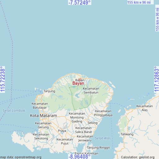
Bayan GPS coordinates[2]
8° 16' 8.04" South, 116° 25' 31.8" East
| Map corner | latitude | longitude |
|---|---|---|
| Upper-left | -7.57249°, | 115.72238° |
| Center: | -8.2689°, | 116.4255° |
| Lower-right: | -8.96408°, | 117.12863° |
| Map W x H: | 154.7×154.7 km | = 96.1×96.1mi |
| max Lat: | 5.88969° ⇑75.2% North |
| Bayan: | -8.2689° |
| min Lat: | ⇓24.8% South -10.934° |
| min Long | Bayan | max Long |
| 95.1345° | 116.4255° | 140.9419° |
| W 77.2%⇐ | ⇒22.8% E |
Elevation
Elevation of Bayan is 222 m = 728 ft, and this is 7.7 m = 25 ft below average elevation for this country.
| Max E: |
3185 m = 10449 ft | 35% |
| Avg. | 229.7 m = 754 ft | |
| Bayan | 222 m = 728 ft | |
Min E: |
-1 m = -3 ft | 65% |
See also: Indonesia elevation on elevation.city.
Geographical zone
Bayan is located in South Torrid zone (between Equator and Tropic of Capricorn). Distance of Equator is 919.4 km =571.3 mi to North.| Distance of | km | miles | from Bayan |
|---|---|---|---|
| Equator | 919.4 | 571.3 | to North |
| Tropic Capricorn | 1686.5 | 1047.9 | to South |
| Antarctic Circle | 6481.8 | 4027.6 | to South |
| South Pole | 9087.6 | 5646.8 | to South |


Nearby cities:
15 places around Bayan: (largest is in red/bold)
• Akarakar
10.5 km =6.5 mi,  300°
300°
• Anyar
4.3 km =2.7 mi,  359°
359°
• Belanting
22.6 km =14 mi,  100°
100°
• Karanggedang
5.9 km =3.7 mi,  330°
330°
• Lelongken
9.8 km =6.1 mi,  127°
127°
• Lokokrangan
18.4 km =11.4 mi,  274°
274°
• Loloan
2.1 km =1.3 mi,  47°
47°
• Montongkemong
28.4 km =17.6 mi,  150°
150°
• Obelobel
13.6 km =8.5 mi,  88°
88°
• Santong
16.2 km =10.1 mi,  250°
250°
• Sembalunbumbung
18.4 km =11.4 mi, 134°
• Sembalunlawang
15.9 km =9.9 mi, 131°
• Tampes
14.2 km =8.8 mi,  285°
285°
• Tanahsong Daya
29.8 km =18.5 mi, 252°
• Todo
29.1 km =18.1 mi, 246°
Sources, notices
• [Note1] Compared only with cities in Indonesia existing in our database
• [Src1] Map data: © OpenStreetMap contributors (CC-BY-SA)
• [Src2] Other city data from geonames.org with taken over terms of usage.
• [Src3] Geographical zone / Annual Mean Temperature by Robert A. Rohde @ Wikipedia
