Sanana geodata
Sanana (North Maluku) is a seat of a second-order administrative division; located in Indonesia in Asia/Jayapura (GMT+9) time zone. In our database, there are 407 cities with bigger population. Compared to other cities in Indonesia, 92.9% of cities are located further ↓South; 98.2% of cities are located further ←West and 90.6% of cities have higher elevation than Sanana. Note1


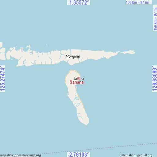
Sanana GPS coordinates[2]
2° 3' 30.708" South, 125° 58' 40.296" East
| Map corner | latitude | longitude |
|---|---|---|
| Upper-left | -1.35572°, | 125.27474° |
| Center: | -2.05853°, | 125.97786° |
| Lower-right: | -2.76103°, | 126.68099° |
| Map W x H: | 156.3×156.3 km | = 97.1×97.1mi |
| max Lat: | 5.88969° ⇑7.1% North |
| Sanana: | -2.05853° |
| min Lat: | ⇓92.9% South -10.934° |
| min Long | Sanana | max Long |
| 95.1345° | 125.97786° | 140.9419° |
| W 98.2%⇐ | ⇒1.8% E |
Elevation
Elevation of Sanana is 10 m = 33 ft, and this is 219.7 m = 721 ft below average elevation for this country.
| Max E: |
3185 m = 10449 ft | 90.6% |
| Avg. | 229.7 m = 754 ft | |
| Sanana | 10 m = 33 ft | |
Min E: |
-1 m = -3 ft | 9.4% |
See also: Indonesia elevation on elevation.city.
Geographical zone
Sanana is located in South Torrid zone (between Equator and Tropic of Capricorn). Distance of Equator is 228.9 km =142.2 mi to North.| Distance of | km | miles | from Sanana |
|---|---|---|---|
| Equator | 228.9 | 142.2 | to North |
| Tropic Capricorn | 2377 | 1477 | to South |
| Antarctic Circle | 7172.3 | 4456.7 | to South |
| South Pole | 9778.2 | 6075.9 | to South |


Nearby cities:
15 places around Sanana: (largest is in red/bold)
• Airbuaya
126.1 km =78.4 mi,  157°
157°
• Banggai
280.4 km =174.2 mi,  280°
280°
• Bobong
177.6 km =110.4 mi,  274°
274°
• Dofa
74.1 km =46 mi,  293°
293°
• Dufa-Dufa
220.2 km =136.8 mi,  36°
36°
• Guruafin
289.6 km =179.9 mi,  33°
33°
• Hila
289.5 km =179.9 mi,  125°
125°
• Kairatu
301.9 km =187.6 mi,  118°
118°
• Labuha
230.6 km =143.3 mi,  46°
46°
• Laiwui
203.7 km =126.6 mi,  67°
67°
• Leksula
200.5 km =124.6 mi, 161°
• Namlea
182.3 km =113.3 mi,  137°
137°
• Namrole
215.4 km =133.8 mi, 157°
• Piru
270.3 km =168 mi,  114°
114°
• Taniwel
291.3 km =181 mi, 107°
Sources, notices
• [Note1] Compared only with cities in Indonesia existing in our database
• [Src1] Map data: © OpenStreetMap contributors (CC-BY-SA)
• [Src2] Other city data from geonames.org with taken over terms of usage.
• [Src3] Geographical zone / Annual Mean Temperature by Robert A. Rohde @ Wikipedia
