Bobong geodata
Bobong (North Maluku) is a seat of a second-order administrative division; located in Indonesia in Asia/Jayapura (GMT+9) time zone. In our database, there are 407 cities with bigger population. Compared to other cities in Indonesia, 93% of cities are located further ↓South; 95.9% of cities are located further ←West and 99.1% of cities have higher elevation than Bobong. Note1


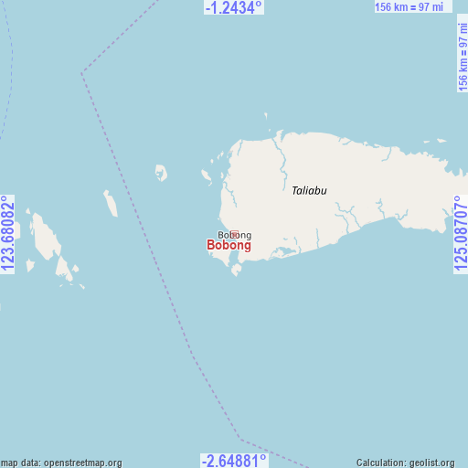
Bobong GPS coordinates[2]
1° 56' 46.5" South, 124° 23' 2.184" East
| Map corner | latitude | longitude |
|---|---|---|
| Upper-left | -1.2434°, | 123.68082° |
| Center: | -1.94625°, | 124.38394° |
| Lower-right: | -2.64881°, | 125.08707° |
| Map W x H: | 156.3×156.3 km | = 97.1×97.1mi |
| max Lat: | 5.88969° ⇑7% North |
| Bobong: | -1.94625° |
| min Lat: | ⇓93% South -10.934° |
| min Long | Bobong | max Long |
| 95.1345° | 124.38394° | 140.9419° |
| W 95.9%⇐ | ⇒4.1% E |
Elevation
Elevation of Bobong is 4 m = 13 ft, and this is 225.7 m = 740 ft below average elevation for this country.
| Max E: |
3185 m = 10449 ft | 99.1% |
| Avg. | 229.7 m = 754 ft | |
| Bobong | 4 m = 13 ft | |
Min E: |
-1 m = -3 ft | 0.9% |
See also: Indonesia elevation on elevation.city.
Geographical zone
Bobong is located in South Torrid zone (between Equator and Tropic of Capricorn). Distance of Equator is 216.4 km =134.5 mi to North.| Distance of | km | miles | from Bobong |
|---|---|---|---|
| Equator | 216.4 | 134.5 | to North |
| Tropic Capricorn | 2389.5 | 1484.8 | to South |
| Antarctic Circle | 7184.8 | 4464.4 | to South |
| South Pole | 9790.7 | 6083.7 | to South |


Nearby cities:
15 places around Bobong: (largest is in red/bold)
• Airbuaya
260.2 km =161.7 mi,  119°
119°
• Banggai
106.1 km =65.9 mi,  292°
292°
• Bilungala
289.7 km =180 mi,  333°
333°
• Bungku
276.2 km =171.6 mi,  256°
256°
• Dofa
110.3 km =68.5 mi,  81°
81°
• Dumoga
286.2 km =177.8 mi,  353°
353°
• Langara
278.1 km =172.8 mi,  213°
213°
• Lolayan
288.4 km =179.2 mi,  358°
358°
• Luwuk
209.1 km =129.9 mi,  301°
301°
• Modayag
295.4 km =183.6 mi, 359°
• Molibagu
263.2 km =163.5 mi, 350°
• Munse
270.1 km =167.8 mi, 207°
• Salakan
140.7 km =87.4 mi, 300°
• Sanana
177.6 km =110.4 mi,  94°
94°
• Tungoo
299.8 km =186.3 mi, 357°
Sources, notices
• [Note1] Compared only with cities in Indonesia existing in our database
• [Src1] Map data: © OpenStreetMap contributors (CC-BY-SA)
• [Src2] Other city data from geonames.org with taken over terms of usage.
• [Src3] Geographical zone / Annual Mean Temperature by Robert A. Rohde @ Wikipedia
