Airbuaya geodata
Airbuaya (Maluku) is a seat of a third-order administrative division; located in Indonesia in Asia/Jayapura (GMT+9) time zone. In our database, there are 407 cities with bigger population. Compared to other cities in Indonesia, 91% of cities are located further ↓South; 98.2% of cities are located further ←West and 67.4% of cities have higher elevation than Airbuaya. Note1


Airbuaya GPS coordinates[2]
3° 6' 10.8" South, 126° 25' 14.52" East
| Map corner | latitude | longitude |
|---|---|---|
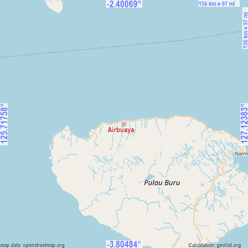
| Upper-left | -2.40069°, | 125.71758° |
| Center: | -3.103°, | 126.4207° |
| Lower-right: | -3.80484°, | 127.12383° |
| Map W x H: | 156.1×156.1 km | = 97×97mi |
| max Lat: | 5.88969° ⇑9% North |
| Airbuaya: | -3.103° |
| min Lat: | ⇓91% South -10.934° |
| min Long | Airbuaya | max Long |
| 95.1345° | 126.4207° | 140.9419° |
| W 98.2%⇐ | ⇒1.8% E |
Elevation
Elevation of Airbuaya is 37 m = 121 ft, and this is 192.7 m = 632 ft below average elevation for this country.
| Max E: |
3185 m = 10449 ft | 67.4% |
| Avg. | 229.7 m = 754 ft | |
| Airbuaya | 37 m = 121 ft | |
Min E: |
-1 m = -3 ft | 32.6% |
See also: Indonesia elevation on elevation.city.
Geographical zone
Airbuaya is located in South Torrid zone (between Equator and Tropic of Capricorn). Distance of Equator is 345 km =214.4 mi to North.| Distance of | km | miles | from Airbuaya |
|---|---|---|---|
| Equator | 345 | 214.4 | to North |
| Tropic Capricorn | 2260.9 | 1404.9 | to South |
| Antarctic Circle | 7056.2 | 4384.5 | to South |
| South Pole | 9662 | 6003.7 | to South |


Nearby cities:
15 places around Airbuaya: (largest is in red/bold)
• Amahusu
203.7 km =126.6 mi,  109°
109°
• Ambon
206.4 km =128.3 mi, 108°
• Dofa
186.8 km =116.1 mi,  321°
321°
• Hila
192.7 km =119.7 mi, 106°
• Kairatu
218 km =135.5 mi,  97°
97°
• Laiwui
239.1 km =148.6 mi,  35°
35°
• Leksula
75.6 km =47 mi,  170°
170°
• Namlea
76.7 km =47.7 mi, 103°
• Namrole
89.2 km =55.4 mi,  157°
157°
• Passo
211.6 km =131.5 mi, 106°
• Pelau
232 km =144.2 mi, 101°
• Piru
197 km =122.4 mi,  88°
88°
• Sanana
126.1 km =78.4 mi,  337°
337°
• Taniwel
230 km =142.9 mi,  83°
83°
• Tulehu
218.4 km =135.7 mi, 104°
Sources, notices
• [Note1] Compared only with cities in Indonesia existing in our database
• [Src1] Map data: © OpenStreetMap contributors (CC-BY-SA)
• [Src2] Other city data from geonames.org with taken over terms of usage.
• [Src3] Geographical zone / Annual Mean Temperature by Robert A. Rohde @ Wikipedia
