Leksula geodata
Leksula (Maluku) is a seat of a third-order administrative division; located in Indonesia in Asia/Jayapura (GMT+9) time zone. In our database, there are 407 cities with bigger population. Compared to other cities in Indonesia, 89.8% of cities are located further ↓South; 98.2% of cities are located further ←West and 63% of cities have lower elevation than Leksula. Note1


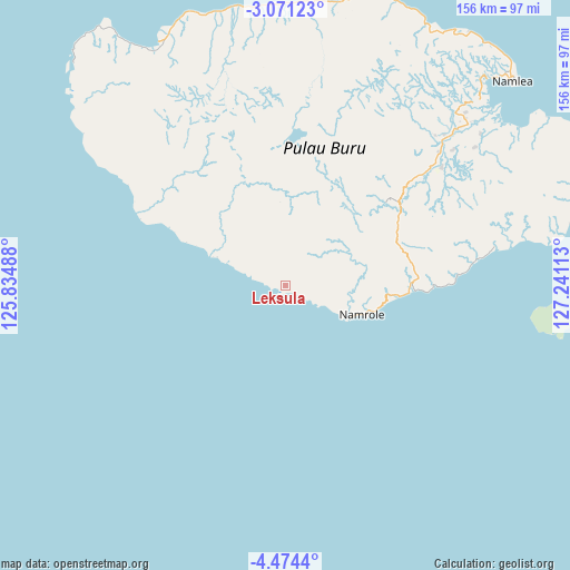
Leksula GPS coordinates[2]
3° 46' 23.16" South, 126° 32' 16.8" East
| Map corner | latitude | longitude |
|---|---|---|
| Upper-left | -3.07123°, | 125.83488° |
| Center: | -3.7731°, | 126.538° |
| Lower-right: | -4.4744°, | 127.24113° |
| Map W x H: | 156×156 km | = 96.9×96.9mi |
| max Lat: | 5.88969° ⇑10.2% North |
| Leksula: | -3.7731° |
| min Lat: | ⇓89.8% South -10.934° |
| min Long | Leksula | max Long |
| 95.1345° | 126.538° | 140.9419° |
| W 98.2%⇐ | ⇒1.8% E |
Elevation
Elevation of Leksula is 197 m = 646 ft, and this is 32.7 m = 107 ft below average elevation for this country.
| Max E: |
3185 m = 10449 ft | 37% |
| Avg. | 229.7 m = 754 ft | |
| Leksula | 197 m = 646 ft | |
Min E: |
-1 m = -3 ft | 63% |
See also: Indonesia elevation on elevation.city.
Geographical zone
Leksula is located in South Torrid zone (between Equator and Tropic of Capricorn). Distance of Equator is 419.5 km =260.7 mi to North.| Distance of | km | miles | from Leksula |
|---|---|---|---|
| Equator | 419.5 | 260.7 | to North |
| Tropic Capricorn | 2186.4 | 1358.6 | to South |
| Antarctic Circle | 6981.6 | 4338.2 | to South |
| South Pole | 9587.5 | 5957.4 | to South |


Nearby cities:
15 places around Leksula: (largest is in red/bold)
• Airbuaya
75.6 km =47 mi,  350°
350°
• Amahusu
178.6 km =111 mi,  88°
88°
• Ambon
182.8 km =113.6 mi, 87°
• Dofa
255.6 km =158.8 mi,  329°
329°
• Hila
173.2 km =107.6 mi,  83°
83°
• Kairatu
208.5 km =129.6 mi, 77°
• Namlea
83.8 km =52.1 mi,  47°
47°
• Namrole
22.4 km =13.9 mi,  111°
111°
• Passo
190.9 km =118.6 mi, 85°
• Pelau
216 km =134.2 mi, 82°
• Piru
200.1 km =124.3 mi,  66°
66°
• Sanana
200.5 km =124.6 mi,  341°
341°
• Saparua
235.7 km =146.5 mi, 84°
• Taniwel
238.4 km =148.1 mi,  64°
64°
• Tulehu
199.6 km =124 mi, 84°
Sources, notices
• [Note1] Compared only with cities in Indonesia existing in our database
• [Src1] Map data: © OpenStreetMap contributors (CC-BY-SA)
• [Src2] Other city data from geonames.org with taken over terms of usage.
• [Src3] Geographical zone / Annual Mean Temperature by Robert A. Rohde @ Wikipedia
