Longnawang geodata
Longnawang (North Kalimantan) is a seat of a third-order administrative division; located in Indonesia in Asia/Makassar (GMT+8) time zone. In our database, there are 407 cities with bigger population. Compared to other cities in Indonesia, 96.9% of cities are located further ↓South; 70.3% of cities are located further ←West and 88.4% of cities have lower elevation than Longnawang. Note1


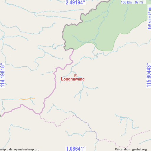
Longnawang GPS coordinates[2]
1° 47' 21.516" North, 114° 54' 4.68" East
| Map corner | latitude | longitude |
|---|---|---|
| Upper-left | 2.49194°, | 114.19818° |
| Center: | 1.78931°, | 114.9013° |
| Lower-right: | 1.08641°, | 115.60443° |
| Map W x H: | 156.3×156.3 km | = 97.1×97.1mi |
| max Lat: | 5.88969° ⇑3.1% North |
| Longnawang: | 1.78931° |
| min Lat: | ⇓96.9% South -10.934° |
| min Long | Longnawang | max Long |
| 95.1345° | 114.9013° | 140.9419° |
| W 70.3%⇐ | ⇒29.7% E |
Elevation
Elevation of Longnawang is 594 m = 1949 ft, and this is 364.3 m = 1195 ft above average elevation for this country.
| Max E: |
3185 m = 10449 ft | 11.6% |
| Longnawang | 594 m 1949 ft | |
| Avg. | 229.7 m = 754 ft | |
Min E: |
-1 m = -3 ft | 88.4% |
See also: Indonesia elevation on elevation.city.
Geographical zone
Longnawang is located in North Torrid zone (between Equator and Tropic of Cancer). Distance of Equator is 199 km =123.7 mi to South.| Distance of | km | miles | from Longnawang |
|---|---|---|---|
| North Pole | 9808.1 | 6094.5 | to North |
| Arctic Circle | 7202.2 | 4475.2 | to North |
| Tropic Cancer | 2407 | 1495.6 | to North |
| Equator | 199 | 123.7 | to South |


Nearby cities:
15 places around Longnawang: (largest is in red/bold)
• Data Dian
47.1 km =29.3 mi,  57°
57°
• Kayan Hulu
250.5 km =155.7 mi,  25°
25°
• Long Bang
251.8 km =156.5 mi, 62°
• Long Beluah
265.9 km =165.2 mi,  66°
66°
• Long Layu
221 km =137.3 mi,  23°
23°
• Long Loreh
232.1 km =144.2 mi,  48°
48°
• Long Peso
232 km =144.2 mi, 64°
• Long Pujungan
133.2 km =82.8 mi, 48°
• Malinau
276.8 km =172 mi,  43°
43°
• Mentarang
246.2 km =153 mi, 34°
• Puruk Cahu
266.2 km =165.4 mi,  187°
187°
• Putussibau
243.2 km =151.1 mi,  244°
244°
• Sendawar
241.9 km =150.3 mi,  158°
158°
• Sungaiboh
40.5 km =25.2 mi,  114°
114°
• Ujoh Bilang
143.1 km =88.9 mi, 164°
Sources, notices
• [Note1] Compared only with cities in Indonesia existing in our database
• [Src1] Map data: © OpenStreetMap contributors (CC-BY-SA)
• [Src2] Other city data from geonames.org with taken over terms of usage.
• [Src3] Geographical zone / Annual Mean Temperature by Robert A. Rohde @ Wikipedia
